Michigan Lake Depths All Michigan lakes
NESW

Tawas Bay

Iosco County, Michigan · NOAA bathymetric survey
43ft Max
depth
7,769 acres 6 contours Public access
Get directions

Depth scale

The lake

Survey readout

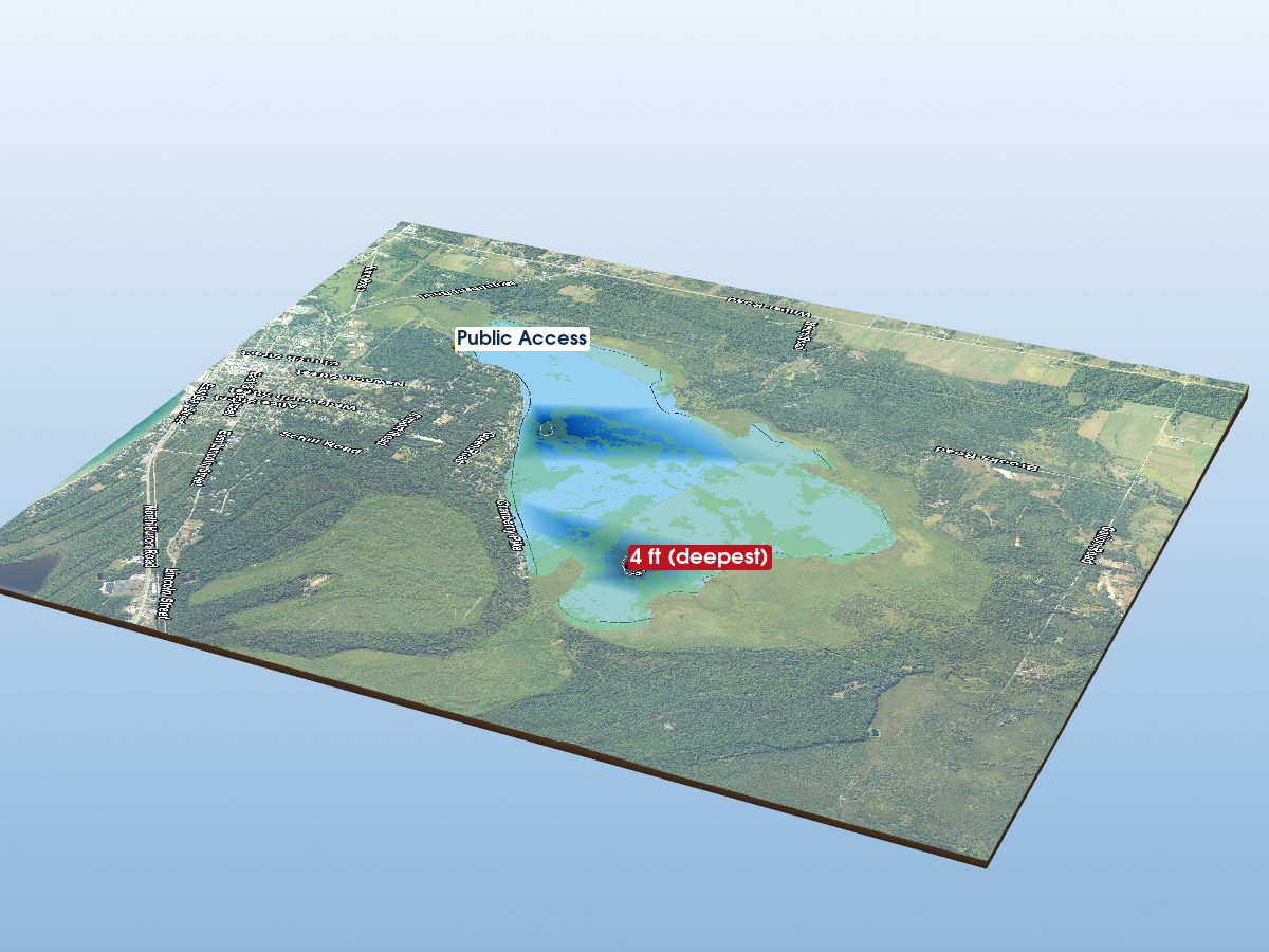
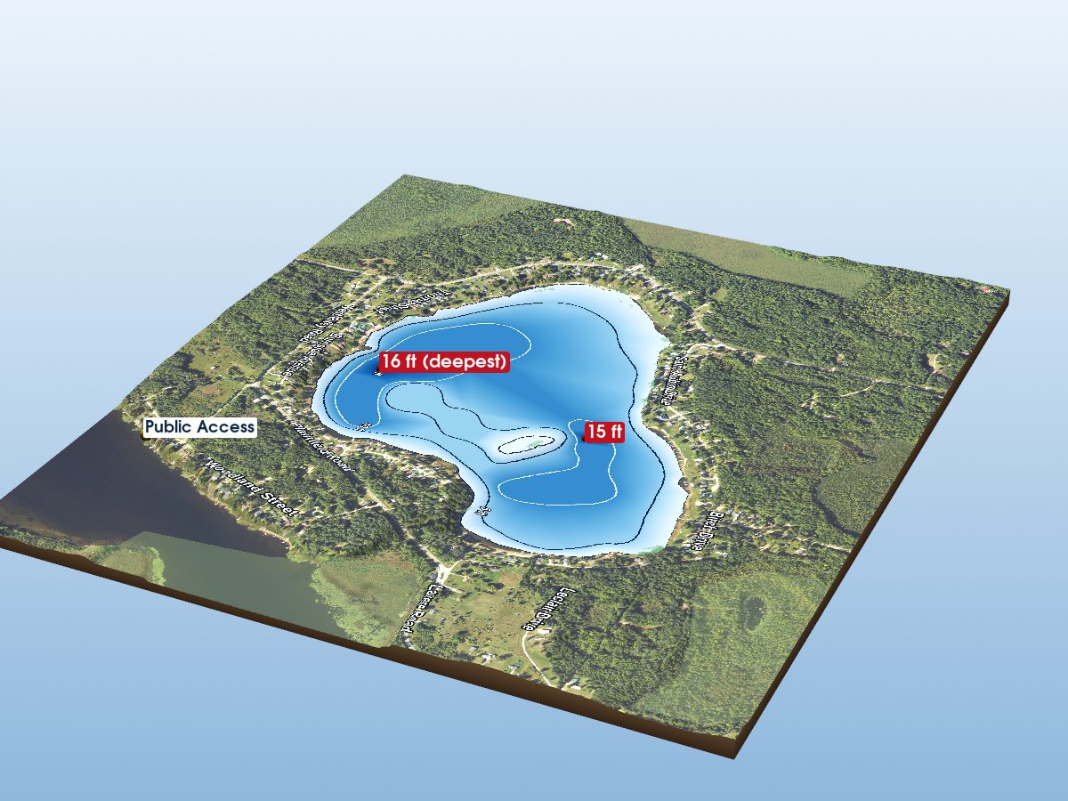
Tawas Bay is mapped to a depth of 43 ft on the NOAA NCEI survey and covers about 7,769 acres in Iosco County, Michigan. Coverage is sparse: about 62% of this lake lies well away from any surveyed contour, so most of the shape shown there is interpolated between distant measurements rather than mapped.

Derived from NOAA NCEI Great Lakes bathymetry data.

The maximum depth and the “deepest” marker describe Tawas Bay itself. The map also renders the surrounding open-lake water inside the frame. Depths in that water reach about 66 ft.

Deepest mapped contour
43 ft
Surface area
7,769 acres
Public access
Boat Launch · Rec Passport
Additional depth details6 contours
Contour depths
0–43 ft
Recorded point soundings
43 ft

Other waters with a public launch on this map: Tawas Lake. Their launches are not marked on the model — only Tawas Bay’s own are.

Compare with another lake
Chart data

Provenance

Sources: NOAA NCEI Great Lakes Bathymetry, USGS 3DEP, OpenStreetMap (ODbL), MI DNR Boat Launches, Contains modified Copernicus Sentinel data (Sentinel-2), processed by michiganlakedepths.com.

⚠ NOT FOR NAVIGATION. This is a recreational depth visualisation built from historical soundings, not a nautical chart. Use official NOAA charts (ENC/RNC) for navigation. Depths are referenced to low water datum and actual water levels vary.

Spot an error? Send a correction

Map details & sources5 sources

All layers registered to one bounding box; positions in WGS 84.

Survey-derived depth contours drape over USGS 3DEP elevation, with a Copernicus Sentinel-2 satellite basemap and OpenStreetMap shoreline. Colour shows surveyed depth; dark lines are the survey's own isobaths.

Coordinates
44.25500, -83.48000
NOAA lake ID
NOAA-GL-TAWAS
Vertical exaggeration
8.0× below the waterline; land at true scale
Basemap
Copernicus Sentinel-2 · ESA, via Microsoft Planetary Computer
Model size
1.8 MB

Fish you might catch

from angler catches

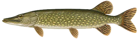
17 species with recent evidence in this lake — sized relative to each other. Illustrations are AI-generated representative adults in everyday colours, not photographs (provenance).
Northern Pike
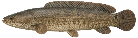
Bowfin
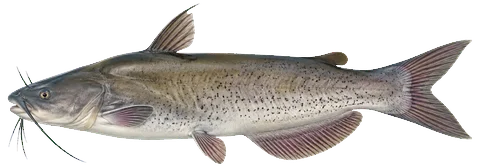
Channel Catfish
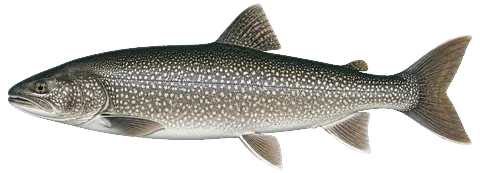
Lake Trout
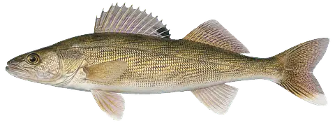
Walleye
Burbot
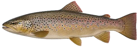
Brown Trout
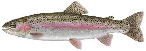
Rainbow Trout
Freshwater Drum
Lake Whitefish
White Sucker
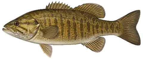
Smallmouth Bass
Menominee Whitefish
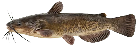
Bullhead
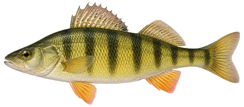
Yellow Perch
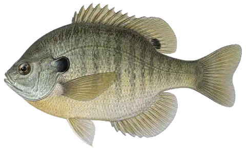
Bluegill
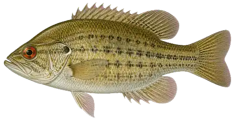
Rock Bass

Fishing rules for this lake Beta

Size and daily limits for the 17 species found here — 17 open to harvest.

These are hook-and-line size, daily limit and season rules. Gear, spearing and bow fishing, spawning closures and rod limits are set by other Fisheries Orders and are not shown here.

BluegillOpen to harvestMinimum size: no size limit · Daily limit: 25 (2026 DNR digest · Great Lakes) The 25 is in any combination of the sunfishes — Bluegill, Pumpkinseed, Black and White Crappie, Rock Bass, Green, Longear and Redear Sunfish, Warmouth and hybrids — not 25 of each (FO-215.23A).
BowfinOpen to harvestMinimum size: no size limit · Daily limit: no possession limit (2026 DNR digest · all other species)
Beta. This panel is newly published. Every value is parsed from the Michigan DNR fisheries orders and hand-checked against the printed digest, but the coverage and wording are still under review. If anything here disagrees with the Michigan DNR's Fisheries Orders or its printed digest, the DNR is right — the signed Fisheries Order is the legal text; the digest summarises it.
Great Lakes water — not the inland tables. Warmwater limits are the digest's General table and FO-215; trout and salmon follow FO-253.26 for management unit MH-4.
BluegillOpen to harvestMinimum size: no size limit · Daily limit: 25 (2026 DNR digest · Great Lakes) The 25 is in any combination of the sunfishes — Bluegill, Pumpkinseed, Black and White Crappie, Rock Bass, Green, Longear and Redear Sunfish, Warmouth and hybrids — not 25 of each (FO-215.23A).
BowfinOpen to harvestMinimum size: no size limit · Daily limit: no possession limit (2026 DNR digest · all other species)
Brown TroutOpen to harvestMinimum size: 10" · Daily limit: 5 trout & salmon in any combination (FO-253.26 · MH-4) Of the 5, no more than 3 may be Brook, Brown, Rainbow (incl. Steelhead), Lake Trout and Splake combined, or Atlantic Salmon (FO-253.26).
BullheadOpen to harvestMinimum size: no size limit · Daily limit: no possession limit (2026 DNR digest · all other species)
BurbotOpen to harvestMinimum size: no size limit · Daily limit: 5 (2026 DNR digest · Burbot)
Channel CatfishOpen to harvestMinimum size: 12" · Daily limit: 10 (2026 DNR digest · Great Lakes)
Freshwater DrumOpen to harvestMinimum size: no size limit · Daily limit: no possession limit (2026 DNR digest · all other species)
Lake TroutOpen to harvestMinimum size: 15" · Daily limit: 5 trout & salmon in any combination (FO-253.26 · MH-4) Lake Huron MH-4: lake trout and splake 15" minimum, open all year. Of the 5, no more than 3 may be Brook, Brown, Rainbow (incl. Steelhead), Lake Trout and Splake combined, or Atlantic Salmon (FO-253.26).
Lake WhitefishOpen to harvestMinimum size: no size limit · Daily limit: 10 in any combination (2026 DNR digest · Cisco/Whitefish (NOTE 7) · Great Lakes) 10 in any combination of Cisco, Lake Whitefish and Round Whitefish on the Great Lakes, connecting waters and Type F lakes; 5 in any combination on other inland waters.
Menominee WhitefishOpen to harvestMinimum size: no size limit · Daily limit: 10 in any combination (2026 DNR digest · Cisco/Whitefish (NOTE 7) · Great Lakes) 10 in any combination of Cisco, Lake Whitefish and Round Whitefish on the Great Lakes, connecting waters and Type F lakes; 5 in any combination on other inland waters.
Northern PikeOpen to harvestMinimum size: 24" · Daily limit: 2 (2026 DNR digest · Great Lakes)
Rainbow TroutOpen to harvestMinimum size: 10" · Daily limit: 5 trout & salmon in any combination (FO-253.26 · MH-4) Of the 5, no more than 3 may be Brook, Brown, Rainbow (incl. Steelhead), Lake Trout and Splake combined, or Atlantic Salmon (FO-253.26). Rainbow Trout here means Rainbow Trout and Steelhead (FO-253.26).
Rock BassOpen to harvestMinimum size: no size limit · Daily limit: 25 (2026 DNR digest · Great Lakes) The 25 is in any combination of the sunfishes — Bluegill, Pumpkinseed, Black and White Crappie, Rock Bass, Green, Longear and Redear Sunfish, Warmouth and hybrids — not 25 of each (FO-215.23A).
Smallmouth BassOpen to harvestMinimum size: 14" · Daily limit: 5 (2026 DNR digest · Great Lakes) The 5 is in any combination of Largemouth and Smallmouth Bass, not 5 of each (FO-215.23A).
WalleyeOpen to harvestMinimum size: 13" · Daily limit: 8 (2026 DNR digest · Great Lakes (NOTE 3)) Tawas Bay is inside Lake Huron management unit MH-4, whose boundary meets the shore at Tawas City on the unit map (2026 digest, p. 20). MH-4 walleye, including Saginaw Bay: 13" minimum, 8 per day, open all year. Changes are announced at Michigan.gov/Fishing (NOTE 3).
White SuckerOpen to harvestMinimum size: no size limit · Daily limit: no possession limit (2026 DNR digest · all other species)
Yellow PerchOpen to harvestMinimum size: no size limit · Daily limit: 25 (2026 DNR digest · Great Lakes)

From the 2026 Michigan Fishing Regulations digest (General Fishing Regulations table and notes) / FO-215.23A (eff. 2023-09-15) / FO-252.26 (eff. 2026-04-01) / FO-240.26 / FO-253.26 (eff. 2026-04-01, Great Lakes trout and salmon by management unit) · verified 2026-08-24. Regulations can change — Michigan DNR rules are the controlling source; verify current regulations before fishing. Official regulations

Compiled from registered Master Angler catches. Silhouettes are stylized and scaled to typical adult sizes relative to one another. Presence is not a promise — fishing isn’t a sure thing.

Notable catches

Master Angler program · 1997–2025

Trophy-size fish anglers caught here and registered with the DNR — what people have actually caught, distinct from what a survey netted or the state stocked below.

101Catches recorded
17Species
Burbot38 recorded · to 38″
Lake Whitefish22 recorded · to 28.2″
Brown Trout8 recorded · to 35″
Channel Catfish5 recorded · to 31.2″
Catch details by species17 species
Burbot38 recorded · to 38″ · latest 2025
Lake Whitefish22 recorded · to 28.2″ · latest 2025
Brown Trout8 recorded · to 35″ · latest 2025
Channel Catfish5 recorded · to 31.2″ · latest 2024
Bullhead4 recorded · to 14.8″ · latest 2025
Lake Trout4 recorded · to 36″ · latest 2025
Northern Pike4 recorded · to 45″ · latest 2025
Walleye3 recorded · to 33″ · latest 2021
White Sucker3 recorded · to 22.2″ · latest 2025
Menominee Whitefish2 recorded · to 20″ · latest 2013
Rock Bass2 recorded · to 12″ · latest 2023
Bluegill1 recorded · to 10.8″ · latest 2010
Bowfin1 recorded · to 28″ · latest 2024
Freshwater Drum1 recorded · to 24″ · latest 1997
Rainbow Trout (Steelhead)1 recorded · to 33″ · latest 2021
Smallmouth Bass1 recorded · to 21.1″ · latest 2003
Yellow Perch1 recorded · to 15″ · latest 2021

Biggest on record

Northern Pike45″ · 2003 · spearfishing · perch
Northern Pike39″ · 2023 · still fishing · artificial lure
Burbot38″ · 2005 · still fishing · minnow
Northern Pike36.2″ · 2023 · spearfishing
Northern Pike36″ · 2025 · ice fishing · live bait

Bait: live bait (38) · minnow (10) · combination (8)
Method: still fishing (44) · ice fishing (21) · spin casting (21) · trolling (9)

Master Angler entries are fish that met the program’s minimum size and were registered by the angler — they show what this lake has produced, not what a day here will produce. A catch on record is history, not a species listing: “Fish you might catch” lists only species with current evidence. Source: Michigan DNR Master Angler data.
Maritime history new
Shipwrecks in Tawas Bay 1 recorded · none with a verified position

Positions are published by the Michigan Underwater Preserve Council. 0 of 1 here have been verified by the state; the rest are approximate and are marked as such.

1 of these wreck has a 3D reconstruction of the ship afloat — tap a labelled marker on the map, or the 3D preview button below. Only wrecks with a reconstruction are marked on the map; the rest are listed below.

  • GoshawkapproximateSchooner Barge, 2-Mast · lost 1920 · foundered full reconstruction40 ft

Treat these as graves. Lives were lost on many Great Lakes wrecks, and human remains may still be present. Michigan’s bottomlands also hold submerged cultural sites that long predate these ships. Look, photograph, and leave everything exactly as you found it.

Removing or disturbing wreckage on Great Lakes bottomlands is a felony under Michigan Part 761, 1994 PA 451, at a fair market value of $100 or more. Positions are historical reference only — not navigation, and not dive-planning data. Wreck records are published by the Michigan Underwater Preserve Council, which publishes a guide to the Thunder Bay preserve.

Quick answers

Tawas Bay — common questions

How deep is Tawas Bay?

The deepest contour on the NOAA NCEI bathymetric survey of Tawas Bay is 43 ft. That is the deepest depth the historical survey map records, which may differ from the deepest point of the lake itself.

How big is Tawas Bay?

Tawas Bay covers about 7,769 acres in Iosco County, Michigan.

What fish are in Tawas Bay?

Species with survey, catch or recent-stocking evidence include brown trout, burbot, channel catfish, lake trout, lake whitefish, northern pike. The page lists all 17 species and the evidence behind each.

Is there public access to Tawas Bay?

Yes. The Michigan DNR boat-launch data identifies 1 public access site on Tawas Bay, including East Tawas Launch Ramp.