Steven M. Selvick
Late diesel-era working appearance
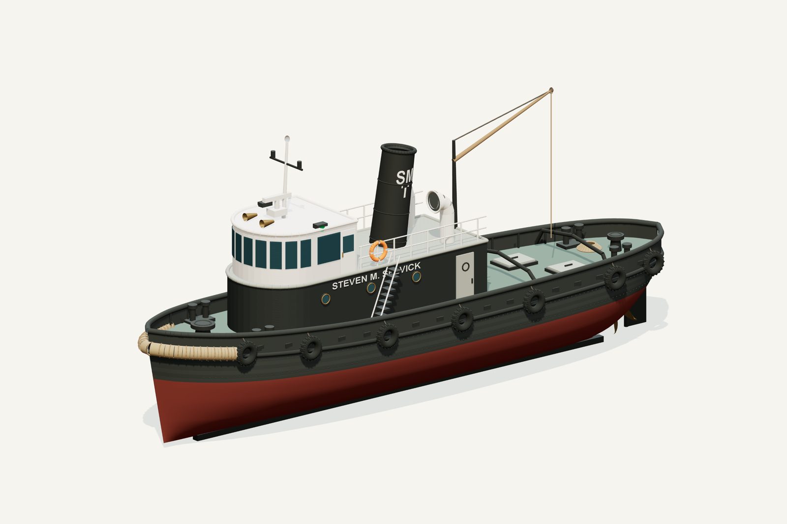
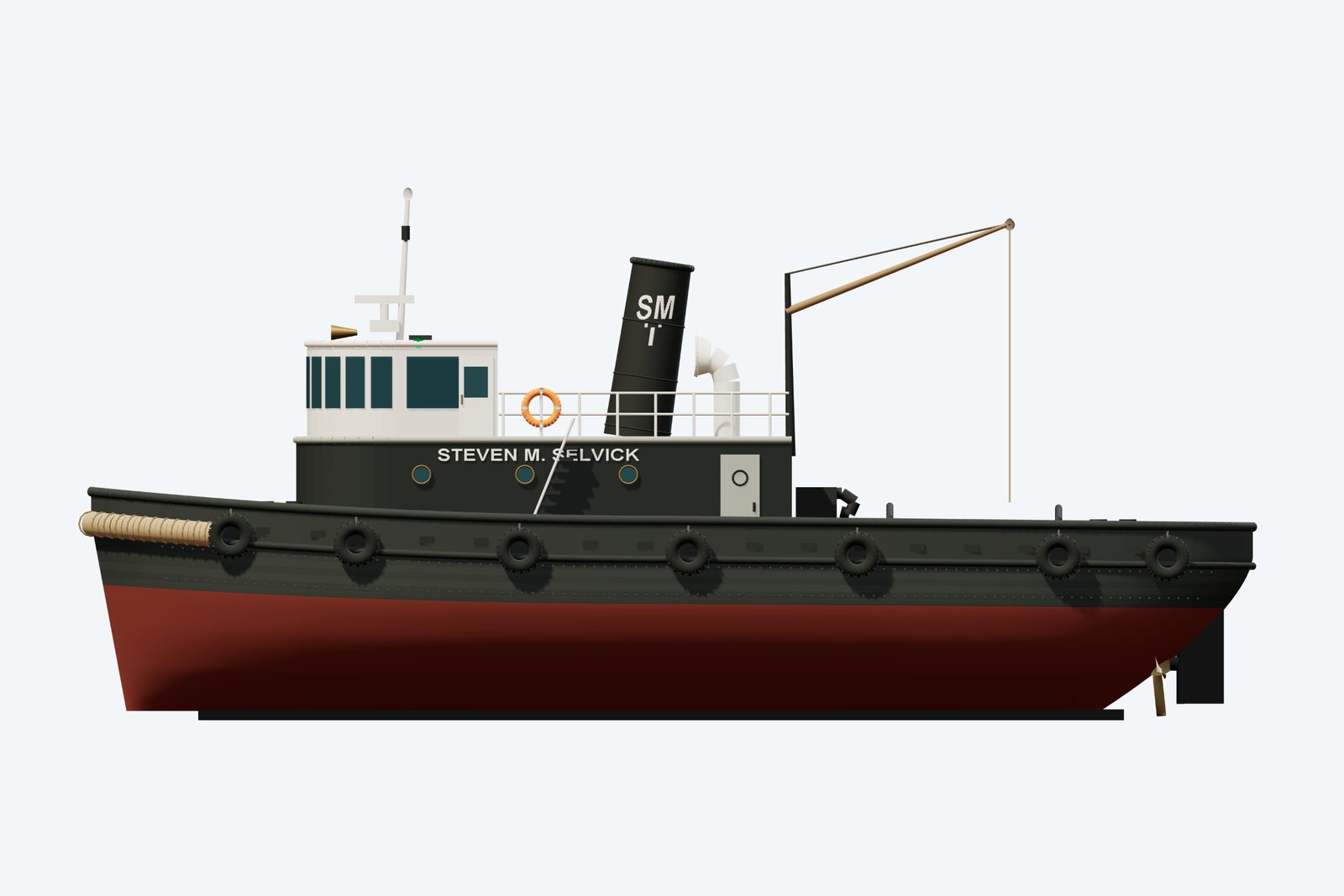
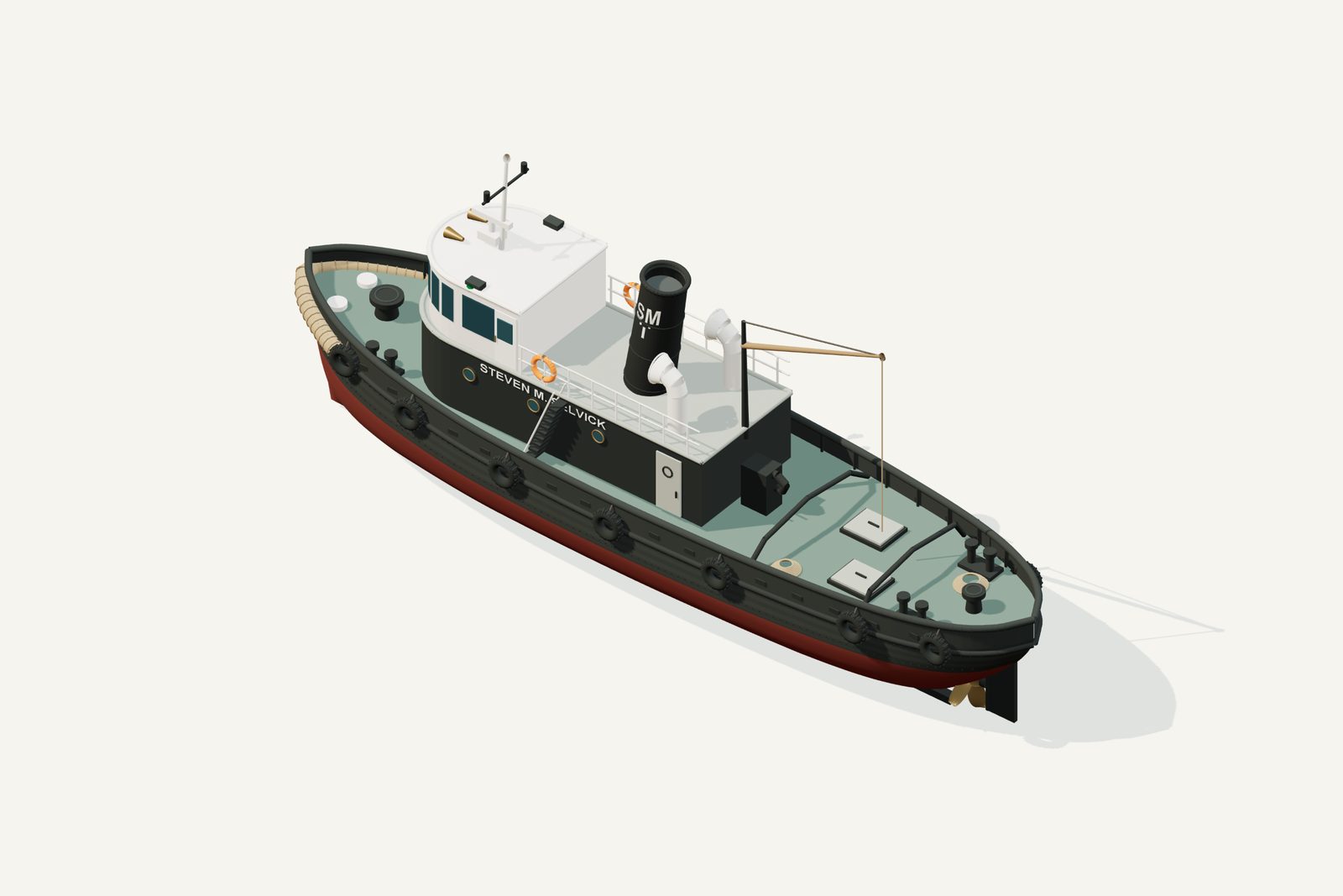
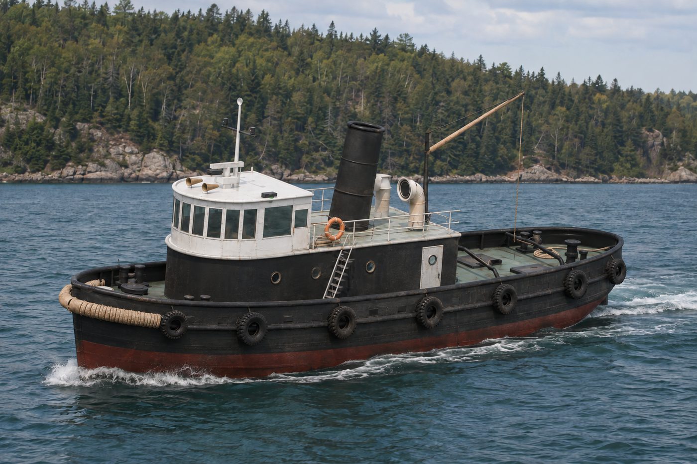
An interpretive 3D reconstruction of the vessel afloat, in the form named above and from before its loss in Munising Bay. It is informed by the historical record set out under History below, where the documented evidence and the interpretation are kept apart; rigging, colours and fittings are partly inferred. It is not a survey of the wreck.
Divers have confirmed exactly where this wreck lies.
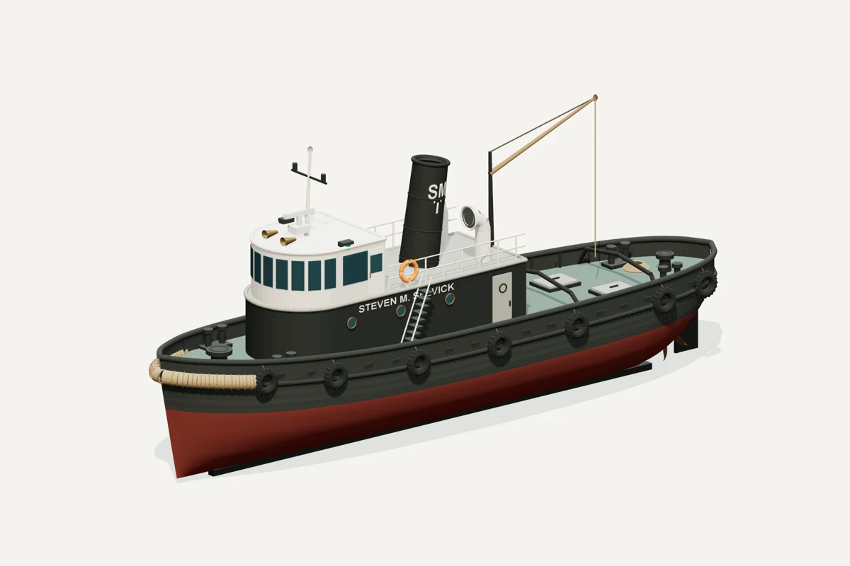
Starboard bow · complete vessel · drag to rotate, scroll or pinch to zoom, right-drag to pan. Hiding a part shows what sat beneath it; it does not recreate the wreck.
What the model represents
From the model specification. Two lists, kept apart on purpose.
Documented
- Steel, single-screw tug, built at Cleveland in 1915 as Lorain. Tugboat Information vessel 11729
- Nominal dimensions 70×17×11 ft; other published lengths differ. Tugboat Information vessel 11729
Inferred
- Exact hull lines, draft and full dimensions of deckhouse
- Working paint shades and fender distribution
- Navigation fittings, railings and rope arrangements
- Detailed towing hardware, hatch dimensions and restored glazing
- Propeller blade pitch and full submerged stern contours
Configuration caveat. Late diesel-era working appearance under the Selvick name, before the 1996 deliberate sinking; not Lorain as built in 1915. Photographs guide the house and funnel, while restored glazing, working fittings and precise dimensions remain interpreted. Published lengths of 69, 70 and 71 ft conflict; geometry uses 70 ft.
Two numbers that are not the same thing. The waterline toggle sits at 2.32 m above the keel, a display assumption, not a measured draft. The wreck lies in about 60 ft of water; that describes the site, not the ship.
Renders from the model
History, evidence and limits
The research notes behind the reconstruction, reproduced with their citations.
Version 1.1. Metadata and presentation revised September 8, 2026; original evidence review retained.
Selected appearance
Late diesel-era working appearance under the Selvick name, before the 1996 deliberate sinking; not Lorain as built in 1915. Photographs guide the house and funnel, while restored glazing, working fittings and precise dimensions remain interpreted. Published lengths of 69, 70 and 71 ft conflict; geometry uses 70 ft.
Documented evidence
Steel, single-screw tug, built at Cleveland in 1915 as Lorain. Tugboat Information vessel 11729
Nominal dimensions 70×17×11 ft; other published lengths differ. Tugboat Information vessel 11729
Reasonable interpretation
Exact hull lines, draft and full dimensions of deckhouse
Working paint shades and fender distribution
Navigation fittings, railings and rope arrangements
Detailed towing hardware, hatch dimensions and restored glazing
Propeller blade pitch and full submerged stern contours
The tug was built at Cleveland in 1915 as Lorain, later named Cabot and Steven M. Selvick. The vessel database identifies steel construction, single-screw propulsion and nominal dimensions of 70 × 17 × 11 ft. The model constrains hull length to 21.336 m and beam to 5.1816 m. Registered hull depth is not a measured operating draft. Tugboat Information, vessel 11729.
Photographs reproduced with the historical sinking account show the forward pilothouse, dark lower deckhouse, single funnel, curved ventilators, light service derrick and low aft working deck. These photographs show a vessel prepared for sinking; the model restores glazing and representative working fittings. The towing photograph is credited to Bert Bowers; the filling/sinking photographs to the Frederick Stonehouse Collection. Illustrated sinking account.
Chris Doyal's photographs on the preserve's page show the surviving bow capstan, foredeck fittings, propeller and ventilators. They informed the corresponding model features without importing or tracing a 3D wreck scan. The preserve describes a 70 ft tug and a nominal 60 ft wreck depth. Michigan Underwater Preserve Council, Alger preserve.
Unresolved uncertainties
No complete original lines plan is claimed. Exact loaded draft, concealed surfaces and fine fittings remain interpreted. The earlier research context below retains the source distinctions used for this reconstruction.
The eyewitness account republished by Michigan DNR establishes the deliberate sinking on June 1, 1996. It describes the former steam tug's later diesel power and prior work on the Mackinac Bridge. Its 71 ft length differs from other published figures. John Pepin, DNR, “Going, going … gone”.
| Item | Treatment |
|---|---|
| Period | Late diesel-era working appearance under the Selvick name, without claiming one exact dated refit. |
| Length | Model uses 70 ft. The user's workbook has 69 ft and the DNR account says 71 ft; the workbook's historical values were preserved. |
| Ownership/refit dates | Published sources differ. The vessel databases give 1972 or 1974 for Selvick acquisition, while the preserve/DNR account gives 1988. Engine-conversion dates also differ. This reconstruction does not resolve those discrepancies. |
| Underwater hull | Smooth, full steel tug form constrained by nominal dimensions. Exact offsets, plate layout, stern contours and draft are inferred. |
| Superstructure | Forward wheelhouse, low deckhouse, funnel and ventilator arrangement follow the photographs; their precise dimensions and window/port counts are interpreted. |
| Propulsion | Single screw and rudder. Blade geometry, pitch and hidden structure are approximations. |
| Restored fittings | Rubber tires, bow rope fender, towing beams, hook, railings, coils, navigation fittings and hatch details are representative working-tug equipment. Their exact configuration aboard this vessel is not established by the references. |
| Paint | Dark hull and lower deckhouse with light pilothouse follow the tonal contrast in photographs. Exact black/green, oxide-red bottom, timber and metal shades are artistic choices. |
| Waterline | Y=2.32 m above keel is an illustrative display assumption, not surveyed draft. |
| Interior | No engine-room or complete cabin interior is claimed or modeled. |
The Great Lakes Tugs & Workboats entry is useful for comparing the conflicting ownership chronology. The disagreement is recorded here rather than concealed by a precise-looking date label.
Sources
- MUPC Alger Underwater Preserve
- DNR eyewitness sinking account
- Tugboat Information vessel 11729
- Historical sinking photographs
Illustration conditions
Lake, shoreline, lighting and weather are artistic staging, not evidence of a specific historical voyage. AI artwork is supplemental; the GLB and direct renders establish the delivered geometry.
Sources used for the model
Rights and respect
Removing or disturbing wreckage on Great Lakes bottomlands is a felony under Michigan Part 761, 1994 PA 451, at a fair market value of $100 or more. Positions are historical reference only — not navigation and not dive-planning data. Wreck records are published by the Michigan Underwater Preserve Council.
Treat these as graves. Lives were lost on many Great Lakes wrecks and human remains may still be present. Look, photograph, and leave everything exactly as you found it.
Model and renders were newly made for this project (2026). Three.js r160.1 is used under the MIT licence; its notice ships with the vendored files. Wreck position, depth and dates: Michigan Underwater Preserve Council. The model specification (version 1.1, revised 2026-09-08) is published beside the assets (model-spec.json).