Julia Palmer - Pendill Creek site
1836–1839 sailing career, before steam conversion and Lake Superior
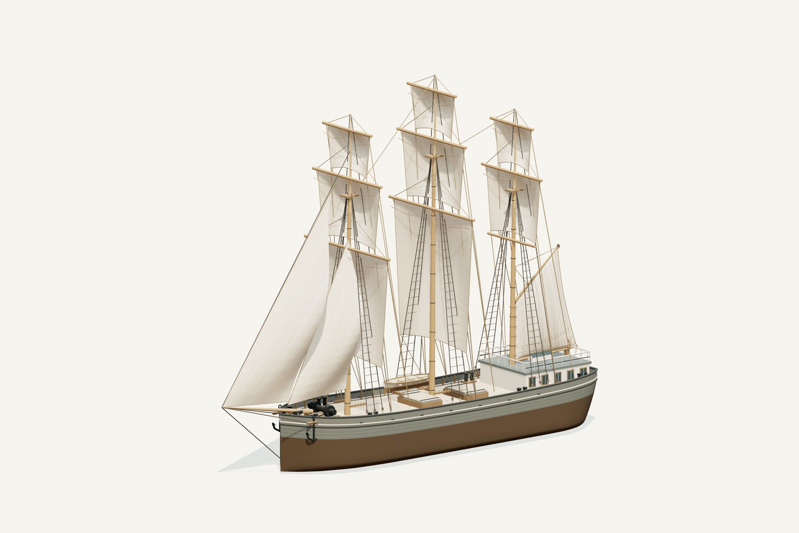
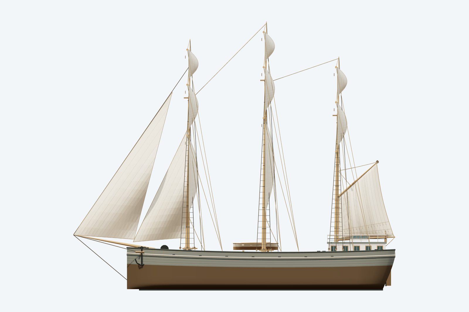
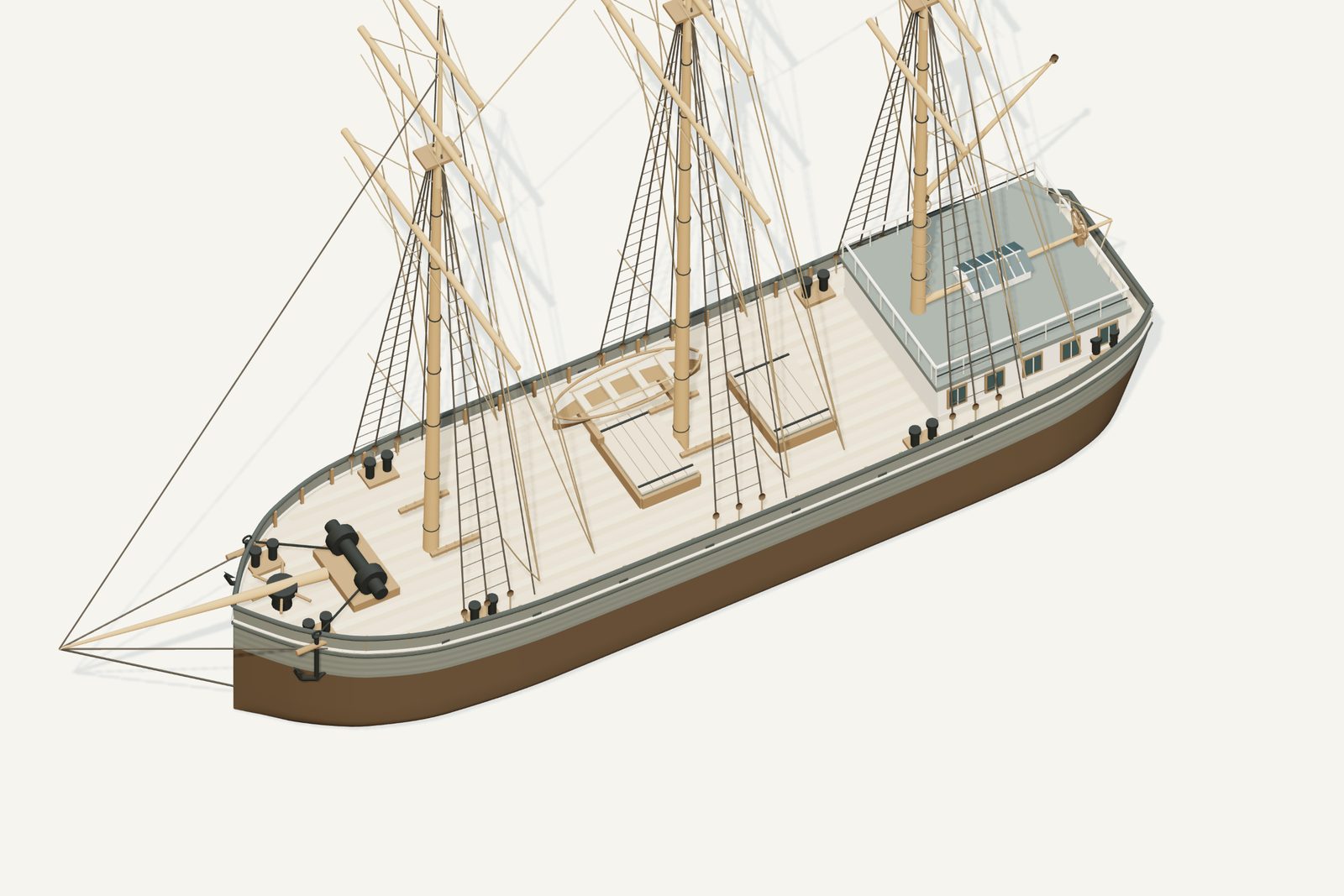
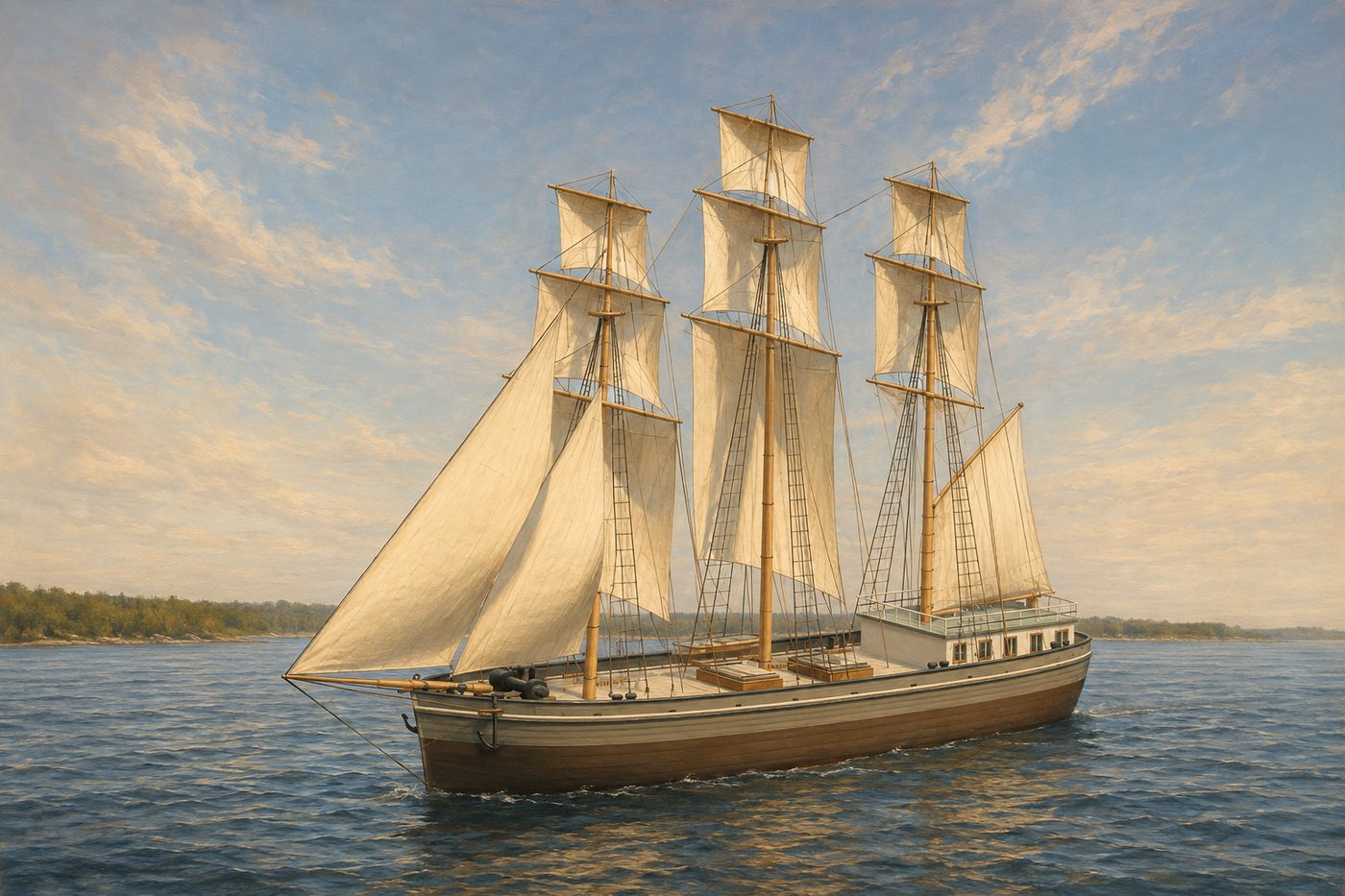
An interpretive 3D reconstruction of the vessel afloat, in the form named above and from before its loss in Whitefish Bay. It is informed by the historical record set out under History below, where the documented evidence and the interpretation are kept apart; rigging, colours and fittings are partly inferred. It is not a survey of the wreck.
This ship was sunk on purpose to serve as a dock. The exact spot is not confirmed, so the marker shows the general area.
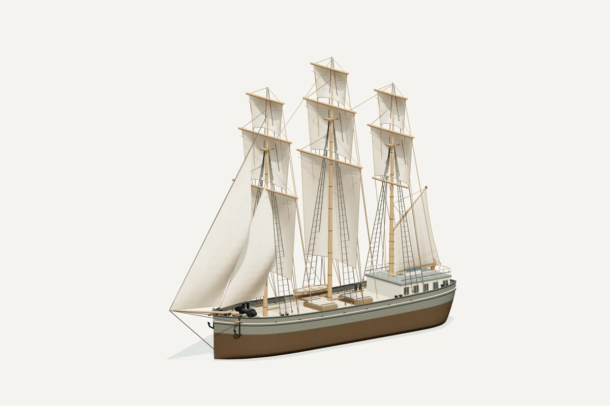
Starboard bow · complete vessel · drag to rotate, scroll or pinch to zoom, right-drag to pan. Hiding the sails shows the deck; it does not recreate the wreck.
What the model represents
From the model specification. Two lists, kept apart on purpose.
Documented
- Mansfield’s launch account gives Buffalo, 1836, 100 × 26.5 × 10 ft and 300 tons, calling the vessel a schooner. History of the Great Lakes, chapter 35.
- Swayze identifies John Carrick of Buffalo as builder, calls the original a bark or full-rigged ship, and records conversion to steam in 1839. Swayze P.
- The vessel was taken over the Sault portage after conversion. A contemporary account reports survival of the November 1, 1847 storm with 45 aboard. Later recovery and use as dock facing are recorded in the compilation. Maritime History record 60983, Cleveland Daily Herald, December 6, 1847, Swayze P.
Inferred
- The model selects a three-masted merchant-ship rig from the ship/full-rigged readings, with three square tiers on fore and main, two on mizzen, a gaff spanker and two headsails. This inventory is not a recovered sail plan.
- Hull lines, rounded stern, low trunk cabin, deck fittings, paint and absolute rig proportions are conventional period interpretations. The model does not reproduce the Augusta plan’s poop or stern board, and that plan is no longer asserted as its hull basis.
Configuration caveat. Pendill Creek identification is unconfirmed. Shown as a merchant sailing ship in 1836–1839, before steam conversion and passage to Lake Superior; one account calls her a schooner. This sailing rig never entered Lake Superior. Hull, deck and rig details are conventional inferences; reported lengths differ.
Two numbers that are not the same thing. The waterline toggle sits at 2.60 m above the keel, a display assumption, not a measured draft. The wreck lies in about 10 ft of water; that describes the site, not the ship.
Renders from the model
History, evidence and limits
The research notes behind the reconstruction, reproduced with their citations.
Version 1.1. Revised September 8, 2026.
Selected appearance
The association of the Pendill Creek remains with Julia Palmer is unconfirmed. This model depicts the earlier sailing career, 1836–1839; the depicted sailing rig never entered Lake Superior. Accounts permit a full-rigged ship interpretation, while one account calls her a schooner.
Documented evidence
Mansfield’s launch account gives Buffalo, 1836, 100 × 26.5 × 10 ft and 300 tons, calling the vessel a schooner. History of the Great Lakes, chapter 35.
Swayze identifies John Carrick of Buffalo as builder, calls the original a bark or full-rigged ship, and records conversion to steam in 1839. Swayze P.
The vessel was taken over the Sault portage after conversion. A contemporary account reports survival of the November 1, 1847 storm with 45 aboard. Later recovery and use as dock facing are recorded in the compilation. Maritime History record 60983, Cleveland Daily Herald, December 6, 1847, Swayze P.
Reasonable interpretation
The model selects a three-masted merchant-ship rig from the ship/full-rigged readings, with three square tiers on fore and main, two on mizzen, a gaff spanker and two headsails. This inventory is not a recovered sail plan.
Hull lines, rounded stern, low trunk cabin, deck fittings, paint and absolute rig proportions are conventional period interpretations. The model does not reproduce the Augusta plan’s poop or stern board, and that plan is no longer asserted as its hull basis.
Unresolved uncertainties
Lengths conflict: 100 ft in Mansfield, 107 ft in the catalogue, 108 ft in Swayze. Geometry retains the explicit Mansfield launch dimensions; no reconciliation is invented.
The historical narrative is an 1847 storm followed by recovery and dock use. The catalogue’s 1848 dock-sinking date is not treated as a resolved casualty date.
The Pendill Creek identification and exact original upper works remain unconfirmed. This is neither a reconstruction of the later sidewheeler nor proof of the wreck’s identity.
Sources
Illustration conditions
Supplemental AI artwork is made from the revised model render where the model changed; the provenance records the actual input files. Lake, shore, sky and weather are artistic staging, not evidence of a final voyage or a measured location. The actual GLB and its direct renders are the geometry reference.
Sources used for the model
Rights and respect
Removing or disturbing wreckage on Great Lakes bottomlands is a felony under Michigan Part 761, 1994 PA 451, at a fair market value of $100 or more. Positions are historical reference only — not navigation and not dive-planning data. Wreck records are published by the Michigan Underwater Preserve Council.
Treat these as graves. Lives were lost on many Great Lakes wrecks and human remains may still be present. Look, photograph, and leave everything exactly as you found it.
Model and renders were newly made for this project (2026). Three.js r160.1 is used under the MIT licence; its notice ships with the vendored files. Wreck position, depth and dates: Michigan Underwater Preserve Council. The model specification (version 1.1, revised 2026-09-08) is published beside the assets (model-spec.json).