Bermuda
Evidence-informed 1860–1870 two-masted canaller associated with the Murray Bay wreck
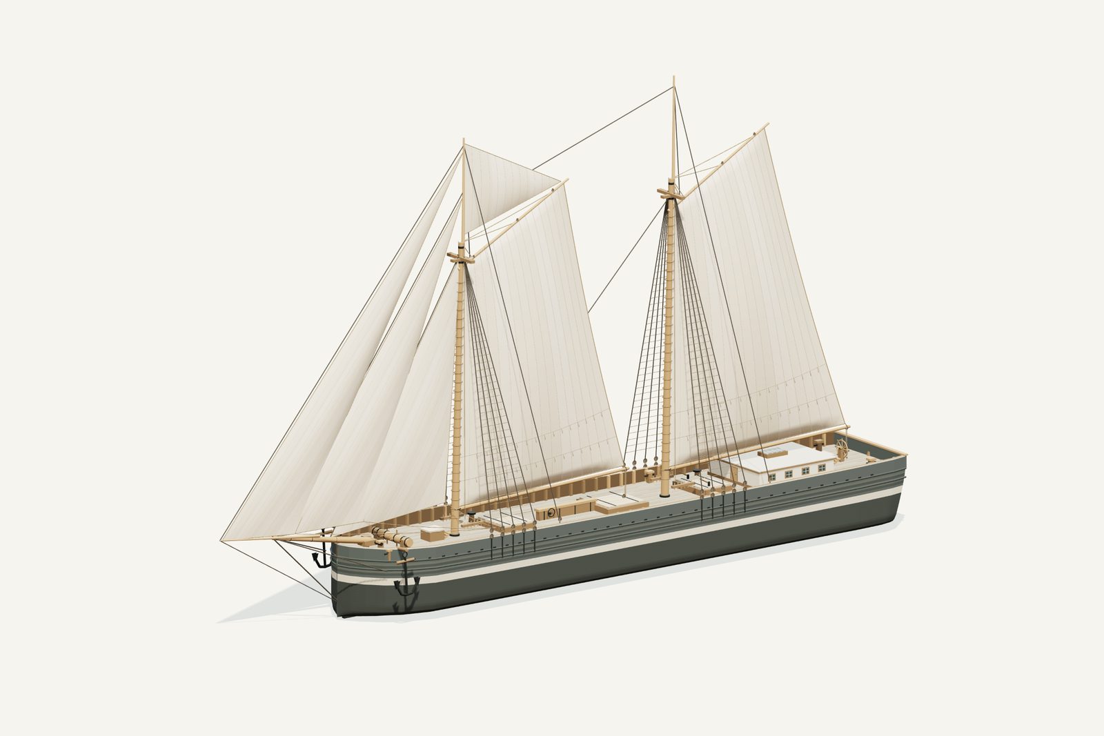
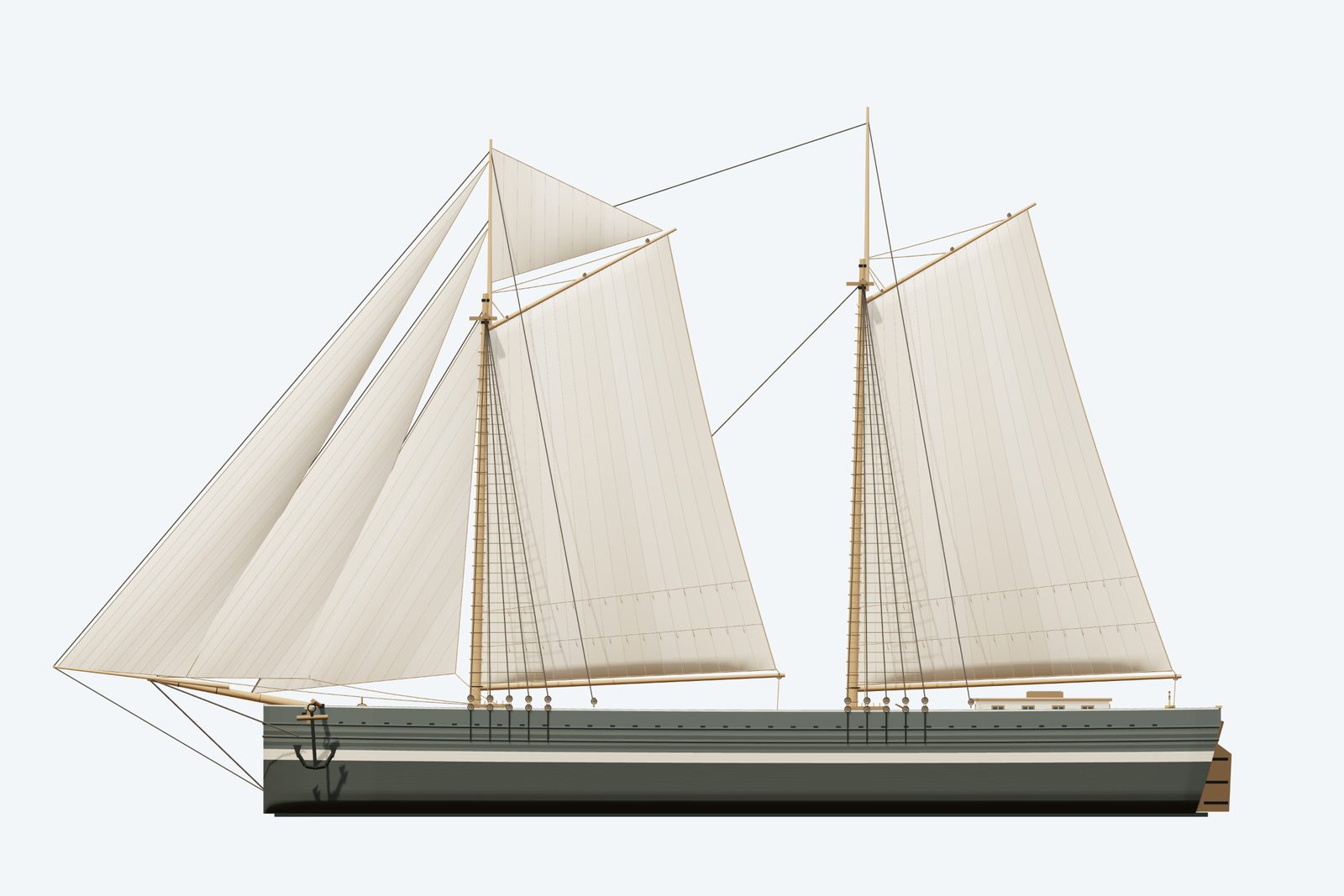
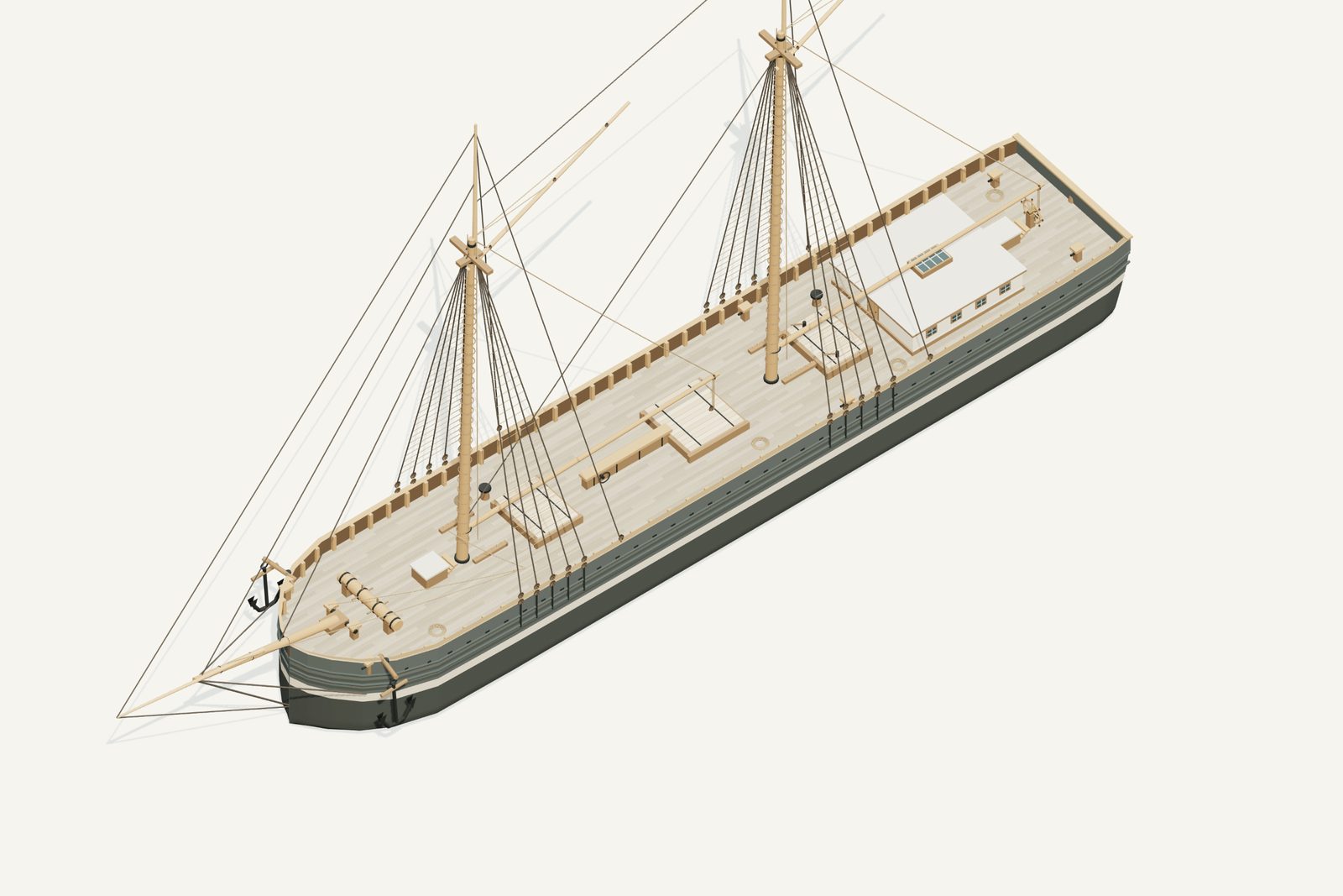
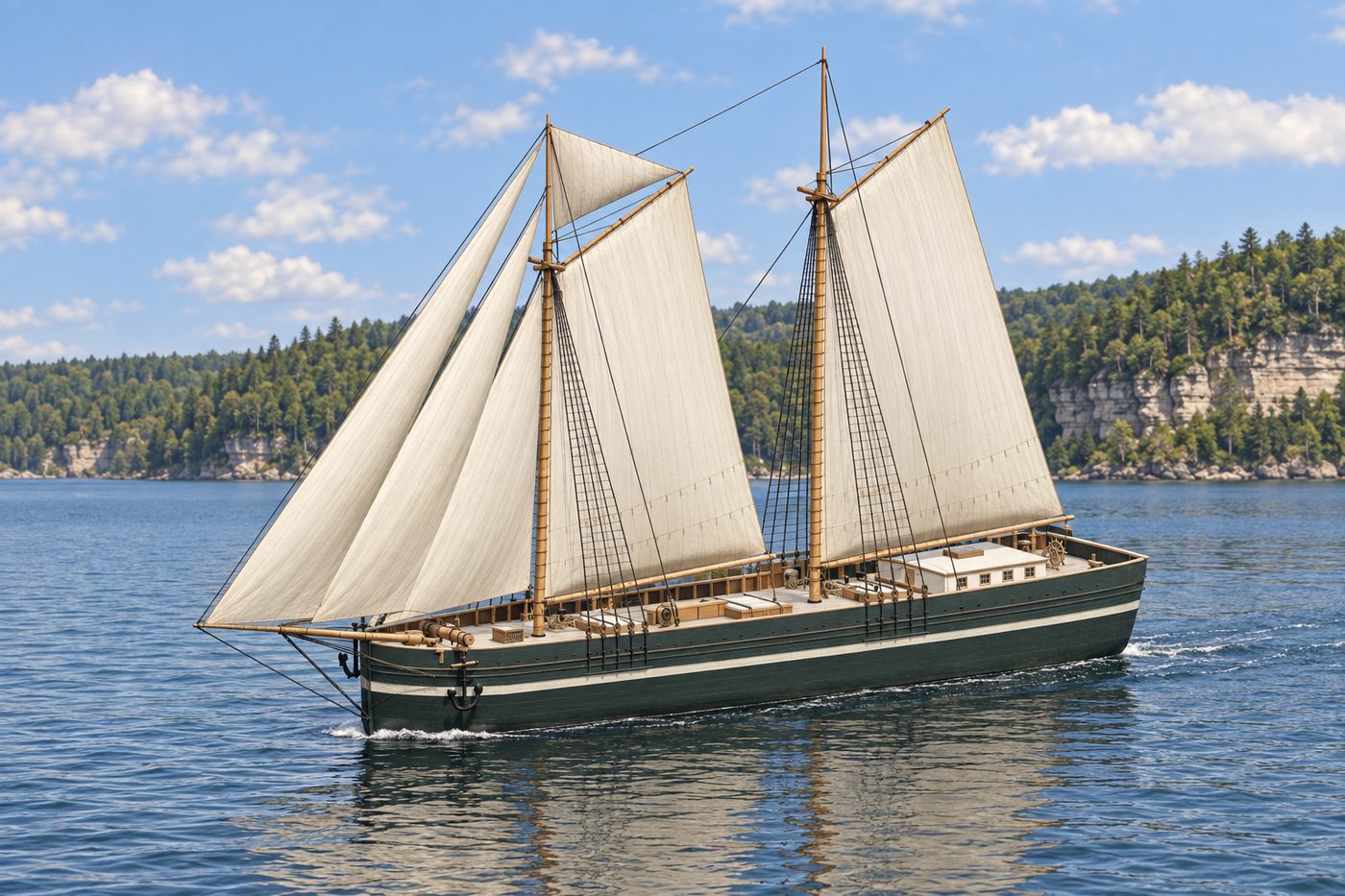
An interpretive 3D reconstruction of the vessel afloat, in the form named above and from before its loss in Munising Bay. It is informed by the historical record set out under History below, where the documented evidence and the interpretation are kept apart; rigging, colours and fittings are partly inferred. It is not a survey of the wreck.
Divers have confirmed exactly where this wreck lies.
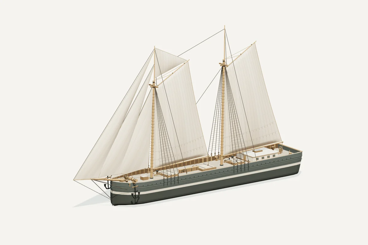
Starboard bow · complete vessel · drag to rotate, scroll or pinch to zoom, right-drag to pan. Hiding the sails shows the deck; it does not recreate the wreck.
What the model represents
From the model specification. Two lists, kept apart on purpose.
Documented
- The WHS report documents straight sides, a flat bottom, sharp bilges, plumb bow, centerboard and a slightly raked flat transom. Figure 29 gives the hull-lines reference. Sailing Canallers: A Great Lakes Regional Context, Technical Report 17-003, pp.35–37.
- The build record identifies George Goble of Oswego, 1860, with a 136 ft hull and 26 ft beam. Naval Marine Archive.
- The Stonehouse/Fountain account describes the foremast about 30 ft abaft the stem, three cargo hatches, two companionways, centerboard trunk and aft cabin. It records three crew drowned in October 1870, later raising and relocation to Murray Bay in 1883, and renewed sinking. The identification is the account’s best explanation of this wreck. Shipwreck Tours.
Inferred
- Three headsails, gaff fore and mainsails, a small fore gaff topsail and dark/light hull bands are transferred from the photograph catalogued as Bermuda. Its attribution is uncertain and these are not direct established Bermuda features.
- The photograph shows a rounded overhanging counter with tumblehome and a boomkin, unlike the archaeological flat transom. The model follows the wreck evidence for its stern.
- The short main boom stopping before the transom is a canaller-type inference, not a specific observed Bermuda measurement.
- Mast heights, exact sail inventory, paint pigments, rigging, small machinery, windows and loaded waterline are interpreted.
Configuration caveat. Archaeology guides the flat raked transom and canaller hull. The photograph catalogued as Bermuda has an uncertain attribution and a conflicting rounded counter; its sail inventory and tonal bands are treated as inferences. Mast heights, paint and missing fittings remain interpreted.
Deliberately not modelled
- Engine
- Propeller
- Cannon
- Figurehead
- Raised forecastle or poop
- Square sails
Two numbers that are not the same thing. The waterline toggle sits at 2.85 m above the keel, a display assumption, not a measured draft. The wreck lies in about 30 ft of water; that describes the site, not the ship.
Renders from the model
History, evidence and limits
The research notes behind the reconstruction, reproduced with their citations.
Version 1.1. Revised September 8, 2026.
Selected appearance
Evidence-informed 1860–1870 two-masted canaller associated with the Murray Bay wreck. Hull and deck arrangement follow archaeology. The often-quoted 30 ft is water depth, not ship length.
Documented evidence
The WHS report documents straight sides, a flat bottom, sharp bilges, plumb bow, centerboard and a slightly raked flat transom. Figure 29 gives the hull-lines reference. Sailing Canallers: A Great Lakes Regional Context, Technical Report 17-003, pp.35–37.
The build record identifies George Goble of Oswego, 1860, with a 136 ft hull and 26 ft beam. Naval Marine Archive.
The Stonehouse/Fountain account describes the foremast about 30 ft abaft the stem, three cargo hatches, two companionways, centerboard trunk and aft cabin. It records three crew drowned in October 1870, later raising and relocation to Murray Bay in 1883, and renewed sinking. The identification is the account’s best explanation of this wreck. Shipwreck Tours.
Reasonable interpretation
Three headsails, gaff fore and mainsails, a small fore gaff topsail and dark/light hull bands are transferred from the photograph catalogued as Bermuda. Its attribution is uncertain and these are not direct established Bermuda features.
The photograph shows a rounded overhanging counter with tumblehome and a boomkin, unlike the archaeological flat transom. The model follows the wreck evidence for its stern.
The short main boom stopping before the transom is a canaller-type inference, not a specific observed Bermuda measurement.
Mast heights, exact sail inventory, paint pigments, rigging, small machinery, windows and loaded waterline are interpreted.
Unresolved uncertainties
The photograph’s only attribution link is the collection catalogue and its photographer is unknown; the stern mismatch materially limits its authority.
Depth of hold around 11 ft 9 in and the database’s rounded 12 ft do not establish loaded draft. Simplified length claims of 130–150 ft differ from the selected 136 ft baseline.
The original builder’s complete rig plan and many salvaged fittings are unavailable. Neither an existing wreck mesh nor its source photos were incorporated.
Sources
- WHS canaller report, Figure 29
- Goble yard record
- Stonehouse/Fountain account
- Contested photographic attribution
- Alpena catalogue
- Wreck inventory

Illustration conditions
Supplemental AI artwork is made from the revised model render where the model changed; the provenance records the actual input files. Lake, shore, sky and weather are artistic staging, not evidence of a final voyage or a measured location. The actual GLB and its direct renders are the geometry reference.
Sources used for the model
Rights and respect
Removing or disturbing wreckage on Great Lakes bottomlands is a felony under Michigan Part 761, 1994 PA 451, at a fair market value of $100 or more. Positions are historical reference only — not navigation and not dive-planning data. Wreck records are published by the Michigan Underwater Preserve Council.
Treat these as graves. Lives were lost on many Great Lakes wrecks and human remains may still be present. Look, photograph, and leave everything exactly as you found it.
Model and renders were newly made for this project (2026). Three.js r160.1 is used under the MIT licence; its notice ships with the vendored files. Wreck position, depth and dates: Michigan Underwater Preserve Council. The model specification (version 1.1, revised 2026-09-08) is published beside the assets (model-spec.json).