Michigan Lake Depths All Michigan lakes
NESW

Crystal Lake

Benzie County, Michigan · MI DNR bathymetric survey
175ft Max
depth
9,797 acres 11 contours Public access
Paddling Index27Modest
Get directions

Depth scale

The lake

Survey readout

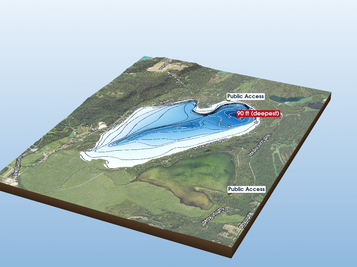
Crystal Lake is mapped to a depth of 175 ft on the Michigan DNR survey and covers about 9,797 acres in Benzie County, Michigan.

Measured from the Michigan DNR inland-lake contour survey (depths read from the survey's isobath field; this lake's summary-depth column is blank in the source).

Deepest sounding
175 ft
Mean depth
69.2 ft · estimated
Surface area
9,797 acres
Estimated volume
677,927 acre-ft · 220,903M gal
Shoreline
20.81 mi · lobed
Aquatic vegetation
11% of surface · NDVI estimate
Public access
Boat Launch
Additional depth details11 contours
Contour depths
0–175 ft
Recorded point soundings
175 ft

Other waters with a public launch on this map: Betsie River, Platte Lake, Steuben Lake, Little Platte Lake, Triangle Lake, Betsie Lake. Their launches are not marked on the model — only Crystal Lake’s own are.

15% of the surface sits over water shallower than 10 ft; 78% is deeper than 20 ft. Depth, area and volume are estimated from the interpolated survey surface — historical reference, not measurement.

Compare with another lake
Chart data

Provenance

Sources: MI DNR inland lake contours, USGS 3DEP, USDA NAIP (public domain), OpenStreetMap (ODbL), MI DNR Boat Launches.

⚠ Not for navigation

Spot an error? Send a correction

Map details & sources5 sources

All layers registered to one bounding box; positions in WGS 84.

Survey-derived depth contours drape over USGS 3DEP elevation, with a USDA NAIP aerial basemap and OpenStreetMap shoreline. Colour shows surveyed depth; dark lines are the survey's own isobaths.

Coordinates
44.66362, -86.17390
MI DNR lake ID
L40101
Vertical exaggeration
4.37× below the waterline; land at true scale
Basemap
USDA NAIP · public domain
Model size
2.4 MB

Paddling

Paddling Index methodology v1.0 · calculated 2026-08-21
27 / 100ModestData confidence: High

Crystal Lake has a substantially developed setting, long open-water fetch, substantial nearby higher-volume roads. No special watercraft restriction is identified in the current source.

Why this score?5 components

Included in the index

ComponentRatingPoints of weightMeasurement
Natural settingModest5.2 of 3038% natural land cover within 150 m of shore (34% forest, 2% wetland; 33% developed)
Geometric wind exposureModest1.2 of 25mean fetch 8,719 m · 0% of sampled water within 500 m of shelter · long open-water fetch
Watercraft controlsNone identified7.5 of 15No special watercraft restriction identified in the current DNR source. Motors permitted, subject to general law.
Public accessGood12.8 of 153 sites with DNR boating-facility records · 16 ramp lanes · 163 trailer spaces
Road isolationModest0.8 of 15substantial nearby higher-volume roads · 315 MDOT-classified segments within 1.2 km, peak 8,731 vehicles/day

Additional paddling considerations

These describe the lake but are not part of the v1 Paddling Index and do not change the number above.

Wake sensitivity
Low — wide enough that wakes disperse over most of the lake
Aquatic vegetation
Low — approximately 11% mapped coverage · NAIP aerial imagery (NDVI)
Observed motorized activity
Unknown — No lake-level measurement of boat traffic is available. Legal permission to operate motors is not evidence of use.
Wildlife habitat potential
Limited — 34% forest and 2% wetland cover within 150 m of shore
How this index is calculated. The Paddling Index is a relative composite derived from lake geometry and public environmental, access, roadway and watercraft-control data. It is not a user review, a safety rating, or a prediction of an individual outing. Differences of a few points should not be treated as meaningful — an 84 and an 82 are broadly comparable. Components and weights: natural setting 30%, geometric wind exposure 25%, watercraft controls 15%, public access 15%, road isolation 15%; observed motorboat activity is weighted 0% because no defensible lake-level measurement exists. Where a component has no data the remaining weights are renormalized and the confidence rating is lowered; below Medium confidence no number is shown. Sources: MI DNR Boating Access Sites (2026-08), MI DNR Watercraft Control Areas (2026-08), USGS/MRLC NLCD Land Cover (2021), MDOT Annual Average Daily Traffic (2025) and MI DNR bathymetric survey outline (0 ft isobath). Conditions change quickly — check current weather and local conditions before going out.

Fish you might catch

from angler catches, DNR surveys & active stocking

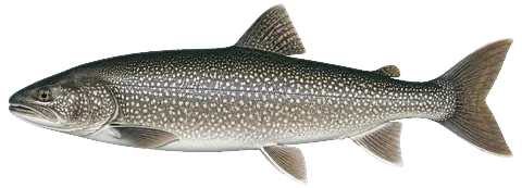
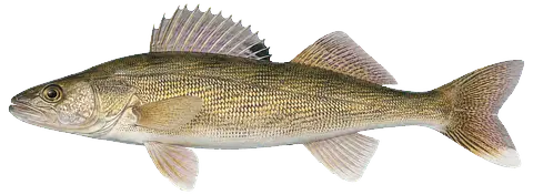
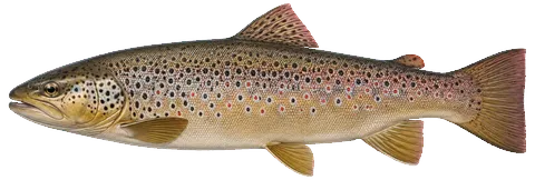
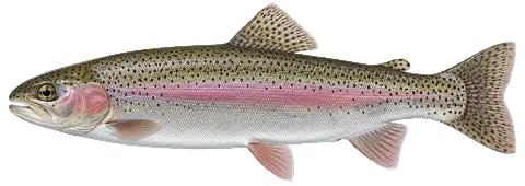
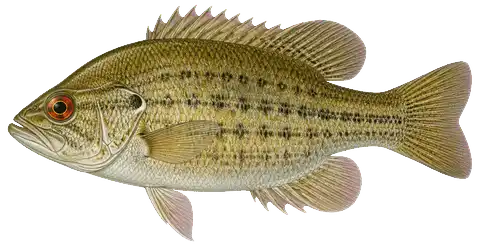
21 species with recent evidence in this lake — sized relative to each other. Illustrations are AI-generated representative adults in everyday colours, not photographs (provenance).

Chinook Salmon
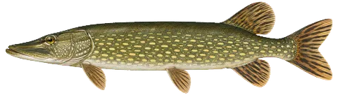
Northern Pike
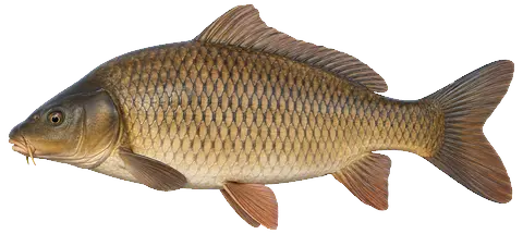
Common Carp
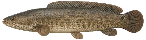
Bowfin
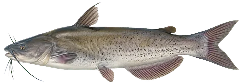
Channel Catfish
Coho Salmon
Lake Trout
Walleye
Burbot
Brown Trout
Rainbow Trout
Freshwater Drum
Lake Whitefish
White Sucker
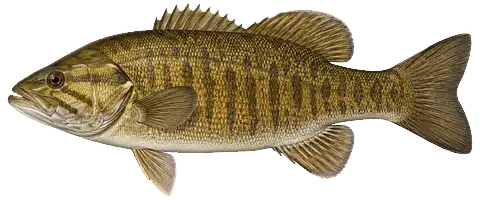
Smallmouth Bass
Cisco
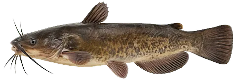
Bullhead
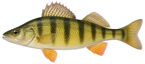
Yellow Perch
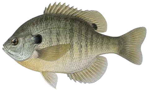
Bluegill
Rock Bass
Rainbow Smelt

Historically stocked, no recent evidence: Atlantic Salmon (last planted 1992) — not shown above.

Fishing rules for this lake Beta

Size and daily limits for the 21 species found here — 21 open to harvest.

These are hook-and-line size, daily limit and season rules. Gear, spearing and bow fishing, spawning closures and rod limits are set by other Fisheries Orders and are not shown here.

BluegillOpen to harvestMinimum size: no size limit · Daily limit: 25 (FO-215 · statewide inland) The 25 is in any combination of the sunfishes — Bluegill, Pumpkinseed, Black and White Crappie, Rock Bass, Green, Longear and Redear Sunfish, Warmouth and hybrids — not 25 of each (FO-215.23A).
BowfinOpen to harvestMinimum size: no size limit · Daily limit: no possession limit (2026 DNR digest · all other species)
Beta. This panel is newly published. Every value is parsed from the Michigan DNR fisheries orders and hand-checked against the printed digest, but the coverage and wording are still under review. If anything here disagrees with the Michigan DNR's Fisheries Orders or its printed digest, the DNR is right — the signed Fisheries Order is the legal text; the digest summarises it.
Designated Type E trout lake — season open for the entire year; tackle: all types of natural bait and artificial lures may be used.
BluegillOpen to harvestMinimum size: no size limit · Daily limit: 25 (FO-215 · statewide inland) The 25 is in any combination of the sunfishes — Bluegill, Pumpkinseed, Black and White Crappie, Rock Bass, Green, Longear and Redear Sunfish, Warmouth and hybrids — not 25 of each (FO-215.23A).
BowfinOpen to harvestMinimum size: no size limit · Daily limit: no possession limit (2026 DNR digest · all other species)
Brown TroutOpen to harvestMinimum size: 15" · Daily limit: 3 (FO-254 · Type E) Three (3) trout.
BullheadOpen to harvestMinimum size: no size limit · Daily limit: no possession limit (2026 DNR digest · all other species)
BurbotOpen to harvestMinimum size: no size limit · Daily limit: 5 (2026 DNR digest · Burbot)
Channel CatfishOpen to harvestMinimum size: 12" · Daily limit: 10 (FO-215 · statewide inland)
Chinook SalmonOpen to harvestMinimum size: 10" · Daily limit: 3 (FO-254 · Type E) Three (3) trout.
CiscoOpen to harvestMinimum size: no size limit · Daily limit: 5 in any combination (2026 DNR digest · Cisco/Whitefish (NOTE 7)) 5 in any combination of Cisco, Lake Whitefish and Round Whitefish on inland waters; 10 on the Great Lakes, connecting waters and Type F lakes.
Coho SalmonOpen to harvestMinimum size: 10" · Daily limit: 3 (FO-254 · Type E) Three (3) trout.
Common CarpOpen to harvestMinimum size: no size limit · Daily limit: no possession limit (2026 DNR digest · all other species)
Freshwater DrumOpen to harvestMinimum size: no size limit · Daily limit: no possession limit (2026 DNR digest · all other species)
Lake TroutOpen to harvestMinimum size: 15" · Daily limit: 3 (FO-254 · Type E) Three (3) trout.
Lake WhitefishOpen to harvestMinimum size: no size limit · Daily limit: 5 in any combination (2026 DNR digest · Cisco/Whitefish (NOTE 7)) 5 in any combination of Cisco, Lake Whitefish and Round Whitefish on inland waters; 10 on the Great Lakes, connecting waters and Type F lakes.
Northern PikeOpen to harvestMinimum size: 24" · Daily limit: 2 (FO-215 · statewide inland)
Rainbow SmeltOpen to harvestMinimum size: no size limit · Daily limit: 2 gallons (2026 DNR digest · Smelt) See the digest's General Netting Regulations table for netting.
Rainbow TroutOpen to harvestMinimum size: 15" · Daily limit: 3 (FO-254 · Type E) Three (3) trout.
Rock BassOpen to harvestMinimum size: no size limit · Daily limit: 25 (FO-215 · statewide inland) The 25 is in any combination of the sunfishes — Bluegill, Pumpkinseed, Black and White Crappie, Rock Bass, Green, Longear and Redear Sunfish, Warmouth and hybrids — not 25 of each (FO-215.23A).
Smallmouth BassOpen to harvestMinimum size: 14" · Daily limit: 5 (FO-215 · statewide inland) The 5 is in any combination of Largemouth and Smallmouth Bass, not 5 of each (FO-215.23A).
WalleyeOpen to harvestMinimum size: 15" · Daily limit: 5 (FO-215 · statewide inland)
White SuckerOpen to harvestMinimum size: no size limit · Daily limit: no possession limit (2026 DNR digest · all other species)
Yellow PerchOpen to harvestMinimum size: no size limit · Daily limit: 25 (FO-215 · statewide inland)

From FO-206.26 (eff. 2026-04-01) / FO-215.23A (eff. 2023-09-15) / FO-254.25 (eff. 2025-10-10), checked against the 2026 Michigan Fishing Regulations digest · verified 2026-08-24. Regulations can change — Michigan DNR rules are the controlling source; verify current regulations before fishing. Official regulations

Compiled from registered Master Angler catches, Michigan DNR fishery surveys and Michigan DNR stockings within the last 10 years. Silhouettes are stylized and scaled to typical adult sizes relative to one another. Presence is not a promise — fishing isn’t a sure thing.

Notable catches

Master Angler program · 1994–2025

Trophy-size fish anglers caught here and registered with the DNR — what people have actually caught, distinct from what a survey netted or the state stocked below.

297Catches recorded
20Species
Rock Bass121 recorded · to 15.5″
Smallmouth Bass37 recorded · to 23.5″
Burbot32 recorded · to 38.1″
Lake Trout22 recorded · to 40.2″
Catch details by species20 species
Rock Bass121 recorded · to 15.5″ · latest 2025
Smallmouth Bass37 recorded · to 23.5″ · latest 2023
Burbot32 recorded · to 38.1″ · latest 2025
Lake Trout22 recorded · to 40.2″ · latest 2025
Smelt21 recorded · to 11.1″ · latest 2011
Chinook Salmon17 recorded · to 41.5″ · latest 2024
Yellow Perch6 recorded · to 14.8″ · latest 2025
Bluegill5 recorded · to 11.2″ · latest 2023
Bowfin5 recorded · to 28″ · latest 2025
Northern Pike5 recorded · to 42.5″ · latest 2017
Brown Trout4 recorded · to 33″ · latest 2025
Cisco4 recorded · to 21.8″ · latest 2023
Walleye4 recorded · to 30.2″ · latest 2021
Coho Salmon3 recorded · to 31.2″ · latest 2024
Freshwater Drum3 recorded · to 31″ · latest 2023
Rainbow Trout (Steelhead)3 recorded · to 34.5″ · latest 2023
Common Carp2 recorded · to 35″ · latest 2002
Bullhead1 recorded · to 15″ · latest 2022
Channel Catfish1 recorded · to 30″ · latest 2017
Lake Whitefish1 recorded · to 25″ · latest 2017

Biggest on record

Northern Pike42.5″ · 1998 · trolling
Northern Pike42″ · 2017 · trolling
Northern Pike42″ · 2010 · spearfishing
Chinook Salmon41.5″ · 2021 · fly fishing · flies
Northern Pike41.4″ · 2017 · trolling

Bait: artificial lure (63) · live bait (34) · minnow (24)
Method: spincasting (102) · still fishing (74) · ice fishing (56) · trolling (41)

Master Angler entries are fish that met the program’s minimum size and were registered by the angler — they show what this lake has produced, not what a day here will produce. A catch on record is history, not a species listing: “Fish you might catch” lists only species with current evidence. Source: Michigan DNR Master Angler data.

Fishery

surveyed 2014 · DNR SFR 2015-202
31,751Fish sampled
9Species

Gamefish Lake Trout 3,438 · Rainbow Trout 48 · Brown Trout 11

Panfish Yellow Perch 23,916

All survey species9 species

Gamefish

Lake Trout3,438 caught
Rainbow Trout48 caught
Brown Trout11 caught

Panfish

Yellow Perch23,916 caught

Forage & nongame

Rainbow Smelt2,611 caught
White Sucker882 caught
Lake Whitefish776 caught
Cisco67 caught · to 17″
Burbot2 caught · to 21″
Stocking: Eventually this idea was abandoned as impractical and Lake Trout populations continue to be supported by stocking.
Length is the largest fish netted in the survey, not an angler record. Source: Michigan DNR Status of the Fishery Resource report (counts summed across survey years).

DNR stocking

state stocking record · 1979–2026

Fish the Michigan DNR has planted in this lake — what was added, distinct from what a survey netted above.

Lake trout3,052,837 stocked · 1979–2026 · 98 plantings
Rainbow trout1,689,794 stocked · 1989–2026 · 94 plantings
Atlantic salmon90,415 stocked · 1986–1992 · 4 plantings
Brown trout252,552 stocked · 1984–1991 · 11 plantings

Non-native species records

4 records

Mussels & snails

  • Zebra Mussel

Plants & algae

  • Eurasian Watermilfoil

Fish

  • Brown TroutMichigan DNR stocking records also document Brown Trout stocking in this lake.
  • Rainbow Smelt
What does non-native mean?

USGS records identify non-native species that have been documented for this lake or its shoreline. Non-native does not necessarily mean invasive, and historical records do not confirm current presence.

Source: Midwest Glacial Lakes Partnership Conservation Planner; underlying nonindigenous species records from the USGS Nonindigenous Aquatic Species database.

At the lake

community-mapped amenities · straight-line distance
⛻ Campgroundon the lake · 3 mapped
🚿 Restrooms / vault toileton the lake · 9 mapped
🏖 Beach / swim areaon the lake · 14 mapped
🎢 Playgroundon the lake · 10 mapped
🥾 Hiking trailhead≈0.6 mi · 2 mapped
From OpenStreetMap community mapping — shown only where something is mapped; an amenity missing here may still exist. Distances are straight-line. Verify before you rely on it. © OpenStreetMap contributors (ODbL).

Bait & tackle nearby

licensed retail bait dealers · straight-line distance
Frankfort Tackle Box≈3.5 mi903 Main St, Frankfort · Google · Apple
Stapleton's Corner Market≈4.7 mi790 Michigan Ave, Benzonia · Google · Apple
Backcast Fly Shop/Benzie Pets≈5.4 mi1675 Benzie Hwy, Benzonia · Google · Apple
Dealers licensed by the Michigan DNR to sell live bait; listing is not an endorsement. Distances are straight-line, not driving — and call ahead: hours and stock change. Source: Michigan DNR retail bait dealer data.
Quick answers

Crystal Lake — common questions

How deep is Crystal Lake?

The deepest contour on the Michigan DNR bathymetric survey of Crystal Lake is 175 ft. That is the deepest depth the historical survey map records, which may differ from the deepest point of the lake itself.

How big is Crystal Lake?

Crystal Lake covers about 9,797 acres in Benzie County, Michigan.

What is the average depth of Crystal Lake?

The estimated mean depth of Crystal Lake is 69.2 ft, calculated from the survey contours.

What fish are in Crystal Lake?

Species with survey, catch or recent-stocking evidence include brown trout, burbot, channel catfish, chinook salmon, coho salmon, lake trout. The page lists all 21 species and the evidence behind each.

Is there public access to Crystal Lake?

Yes. The Michigan DNR boat-launch data identifies 2 public access sites on Crystal Lake, including Crystal Lake.