James H. Hall
Two-masted sailing form shown in historical image
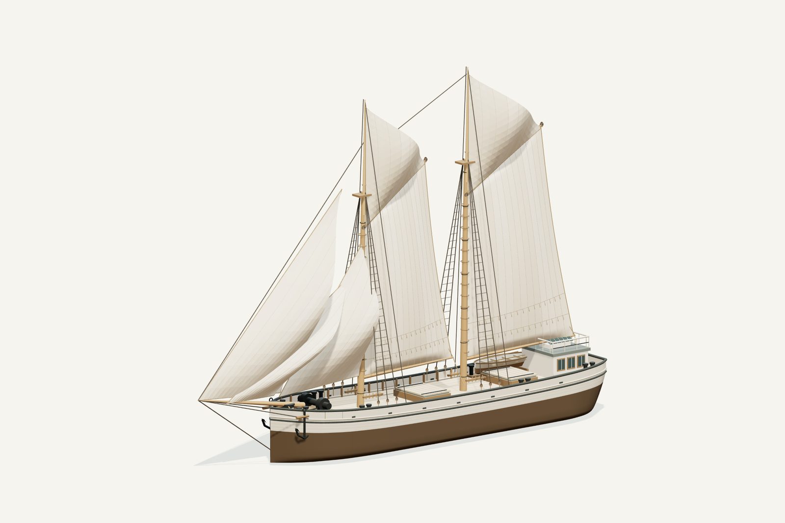
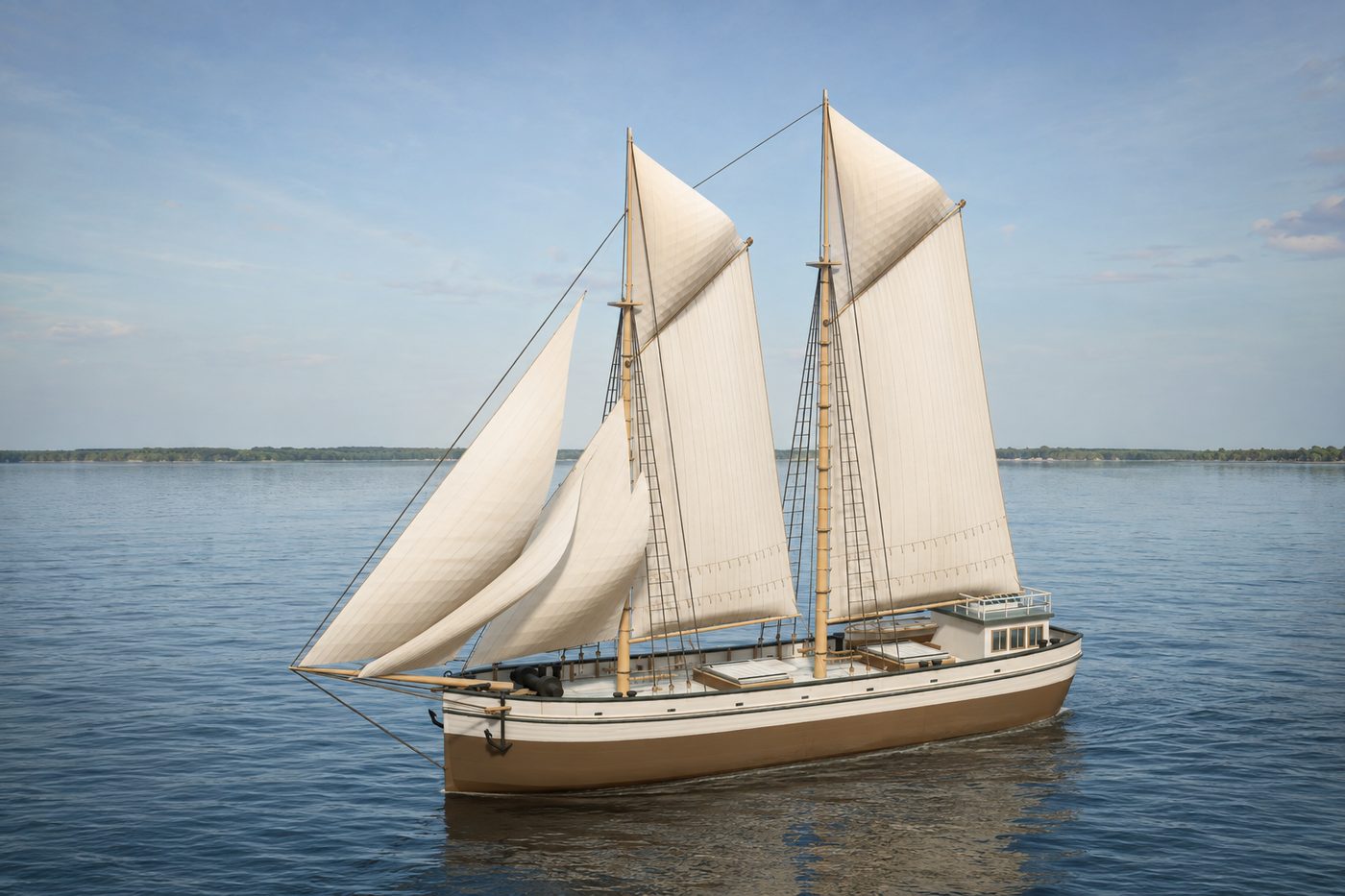
An interpretive 3D reconstruction of the vessel afloat, in the form named above and from before its loss in Thunder Bay. It is informed by the historical record set out under History below, where the documented evidence and the interpretation are kept apart; rigging, colours and fittings are partly inferred. It is not a survey of the wreck.
This ship ran aground along this shore. Nobody knows the exact spot, so the marker shows the general area.
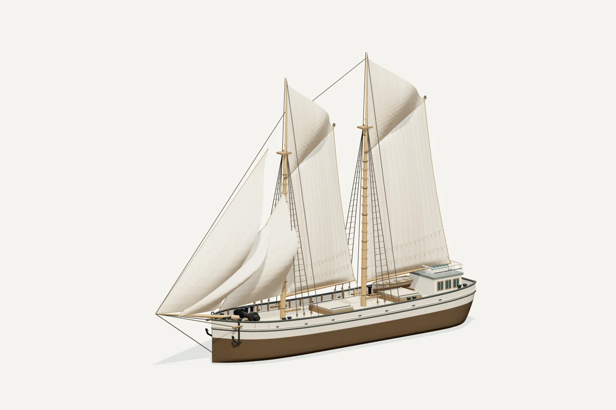
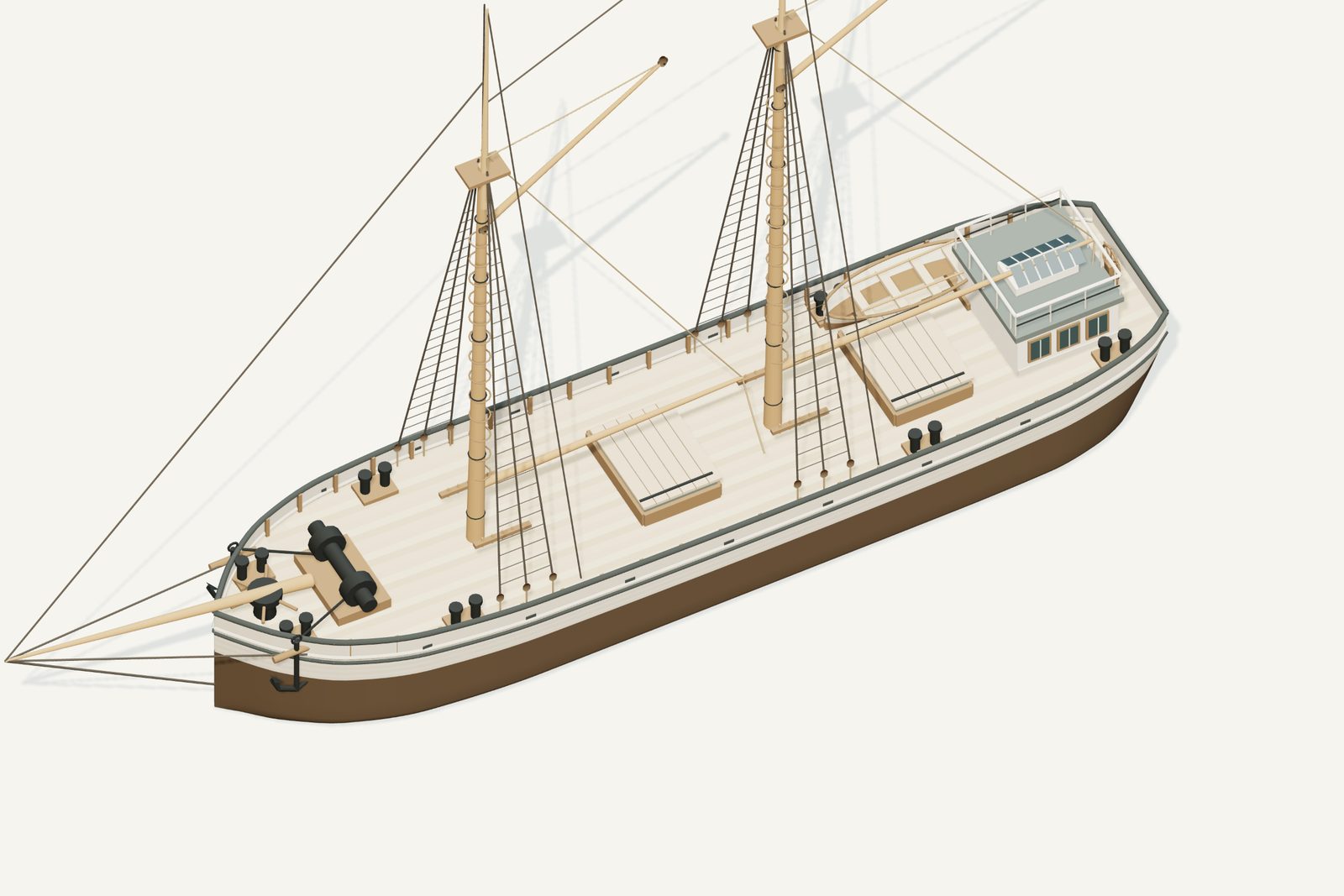
Starboard bow · complete vessel · drag to rotate, scroll or pinch to zoom, right-drag to pan. Hiding the sails shows the deck; it does not recreate the wreck.
What the model represents
From the model specification. Two lists, kept apart on purpose.
Documented
- Built by Hanson and Scove at Manitowoc in 1885; NOAA dimensions 91×22 ft. NOAA vessel record
- NOAA’s text says three masts while its historical image shows two; the model follows the image and retains the conflict. NOAA vessel record
Inferred
- Underwater hull lines and draft
- Exact colors, fittings, hatch layout and rigging routes
- Absolute spar heights and sail shapes
Configuration caveat. The historical image on NOAA’s page clearly shows two masts with gaff sails and topsails; its text instead labels three masts. This model follows the image, not a proven loss-day configuration. Seven display sails, hull lines, deck layout and paint are interpretations.
Two numbers that are not the same thing. The waterline toggle sits at 1.85 m above the keel, a display assumption, not a measured draft. The wreck lies in about 6 ft of water; that describes the site, not the ship.
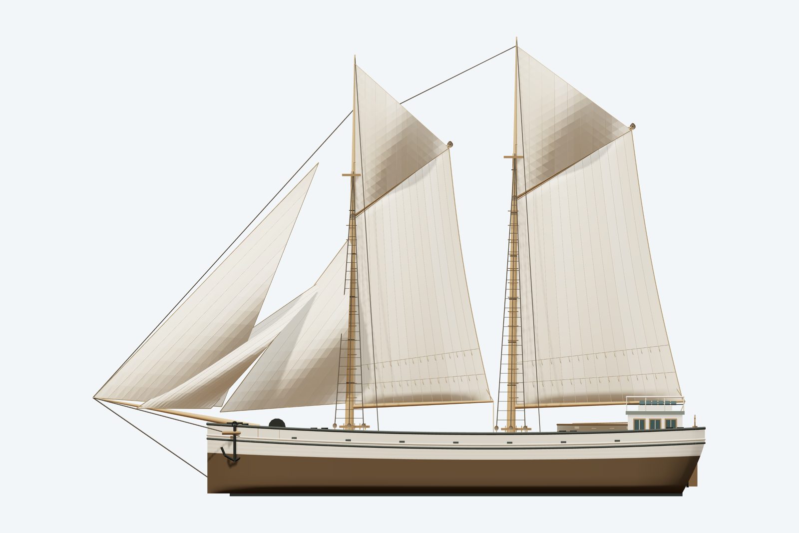
Renders from the model
History, evidence and limits
The research notes behind the reconstruction, reproduced with their citations.
Version 1.1. Metadata and presentation revised September 8, 2026; original evidence review retained.
Selected appearance
Two-masted sailing form shown in historical image. The historical image on NOAA’s page clearly shows two masts with gaff sails and topsails; its text instead labels three masts. This model follows the image, not a proven loss-day configuration. Seven display sails, hull lines, deck layout and paint are interpretations.
Documented evidence
Built by Hanson and Scove at Manitowoc in 1885; NOAA dimensions 91×22 ft. NOAA vessel record
NOAA’s text says three masts while its historical image shows two; the model follows the image and retains the conflict. NOAA vessel record
Reasonable interpretation
Underwater hull lines and draft
Exact colors, fittings, hatch layout and rigging routes
Absolute spar heights and sail shapes
Visual evidence and comparisons. The named historical image was inspected: two tall masts, two gaff mainsails, triangular topsails, headsails and a projecting bowsprit. It directly supports the selected sailing silhouette. The small image is not a measured sail plan, and its precise date was not established.
Reasonable interpretations and limits. Seven display sails are chosen: two gaff sails, two topsails and three headsails. Counts and overlapping sail edges beyond the two principal gaffs are interpreted from a limited-resolution image. Long bowsprit, sheer and compact aft cabin follow that visual family; hull lines, spar dimensions, cabin placement, hatch layout, colors and fittings are not exact recoveries. This is the image-guided sailing era, not a claim that the boat retained this exact rig at loss or throughout its career. No later engine or undocumented conversion is modeled.
Further sources and how they were used.
Unresolved uncertainties
No complete original lines plan is claimed. Exact loaded draft, concealed surfaces and fine fittings remain interpreted. The earlier research context below retains the source distinctions used for this reconstruction.
Evidence assessment: build a qualified interpretation. The selected vessel class, dimensions and the evidence described below support a credible overall likeness. It is not an exact or authenticated as-built replica.
Documented baseline and source differences. NOAA gives 91 × 22 ft, construction in 1885 by Hanson and Scove at Manitowoc, and a 1916 loss. Its page labels the vessel three-masted, while the historical image displayed on that same page visibly has two masts. The tracker also lists two. NOAA vessel record.
Selected geometry references. Hull length 91 ft; beam 22 ft. Hold depth unknown (null). Model deck Y=2.8 m and waterline Y=1.85 m are illustrative construction coordinates, not surveyed draft. Wreck water depth is not vessel draft. Existing approximate map coordinates, site attribution and catalogue text were preserved.
Sources
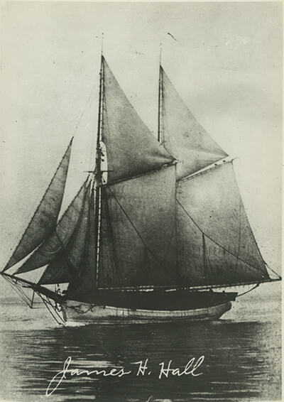
Illustration conditions
Lake, shoreline, lighting and weather are artistic staging, not evidence of a specific historical voyage. AI artwork is supplemental; the GLB and direct renders establish the delivered geometry.
Sources used for the model
Rights and respect
Removing or disturbing wreckage on Great Lakes bottomlands is a felony under Michigan Part 761, 1994 PA 451, at a fair market value of $100 or more. Positions are historical reference only — not navigation and not dive-planning data. Wreck records are published by the Michigan Underwater Preserve Council.
Treat these as graves. Lives were lost on many Great Lakes wrecks and human remains may still be present. Look, photograph, and leave everything exactly as you found it.
Model and renders were newly made for this project (2026). Three.js r160.1 is used under the MIT licence; its notice ships with the vendored files. Wreck position, depth and dates: Michigan Underwater Preserve Council. The model specification (version 1.1, revised 2026-09-08) is published beside the assets (model-spec.json).