James Davidson
Working form with reinforcing arches, 1877–1883
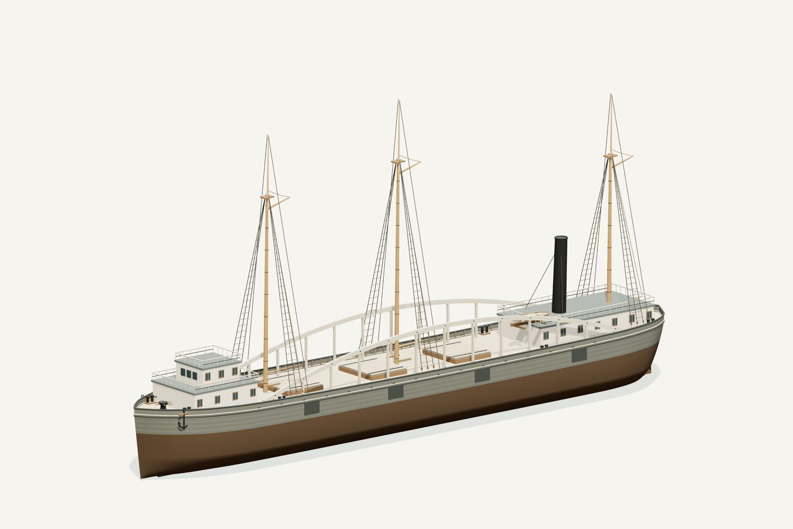
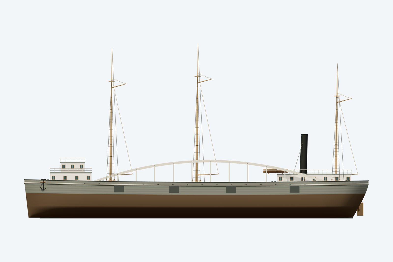
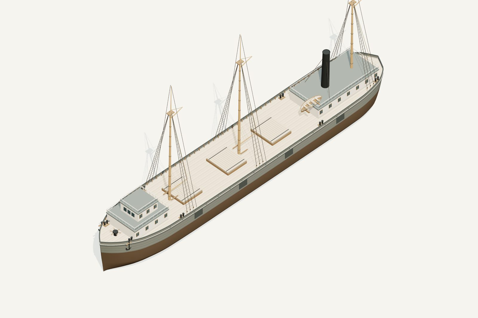
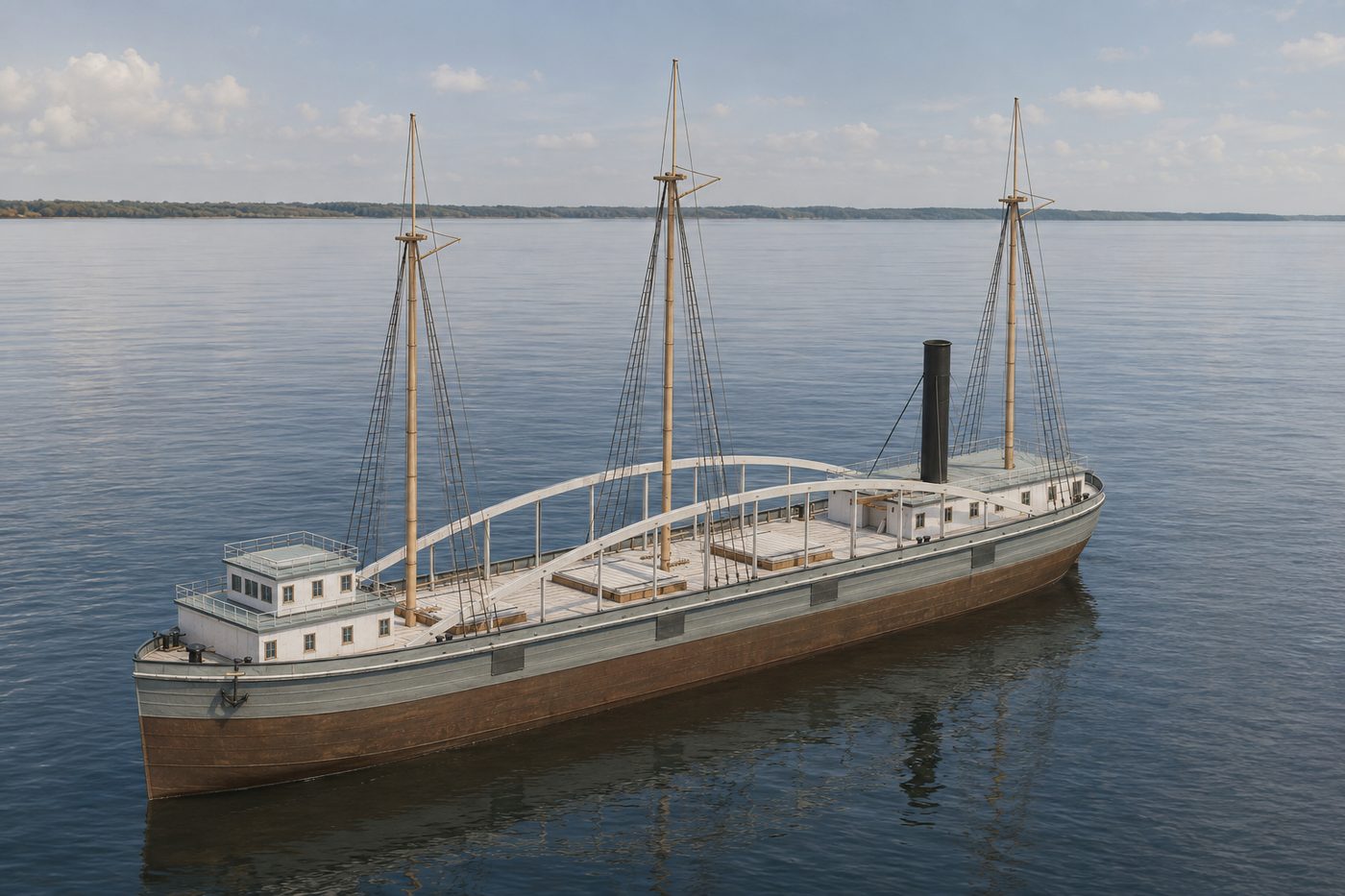
An interpretive 3D reconstruction of the vessel afloat, in the form named above and from before its loss in Thunder Bay. It is informed by the historical record set out under History below, where the documented evidence and the interpretation are kept apart; rigging, colours and fittings are partly inferred. It is not a survey of the wreck.
This ship ran aground along this shore. Nobody knows the exact spot, so the marker shows the general area.
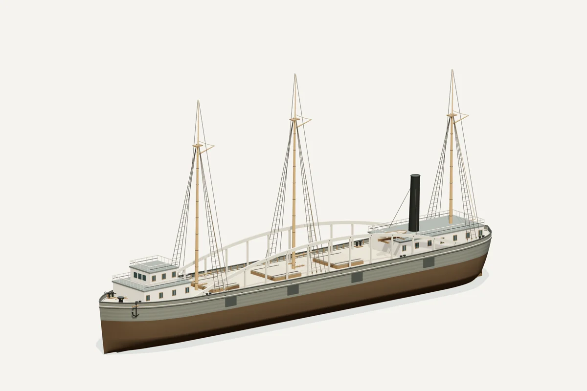
Starboard bow · complete vessel · drag to rotate, scroll or pinch to zoom, right-drag to pan. Hiding a part shows what sat beneath it; it does not recreate the wreck.
What the model represents
From the model specification. Two lists, kept apart on purpose.
Documented
- NOAA’s historical account gives 230 ft 6 in length, 37 ft beam and 19 ft 6 in hold depth. NOAA James Davidson historical account
- Three masts and screw propulsion are recorded, with reinforcing arches added in 1877. NOAA James Davidson historical account
Inferred
- Underwater hull lines and draft
- Exact colors, fittings, hatch layout and rigging routes
Configuration caveat. NOAA’s historical account gives 230 ft 6 in × 37 ft and three masts, with reinforcing arches added in 1877. Its vessel page lists smaller surviving wreck dimensions. Photographs guide the silhouette; arch curvature, deck arrangement and paint are interpreted.
Two numbers that are not the same thing. The waterline toggle sits at 4.90 m above the keel, a display assumption, not a measured draft. The wreck lies in about 35 ft of water; that describes the site, not the ship.
Renders from the model
History, evidence and limits
The research notes behind the reconstruction, reproduced with their citations.
Version 1.1. Metadata and presentation revised September 8, 2026; original evidence review retained.
Selected appearance
Working form with reinforcing arches, 1877–1883. NOAA’s historical account gives 230 ft 6 in × 37 ft and three masts, with reinforcing arches added in 1877. Its vessel page lists smaller surviving wreck dimensions. Photographs guide the silhouette; arch curvature, deck arrangement and paint are interpreted.
Documented evidence
NOAA’s historical account gives 230 ft 6 in length, 37 ft beam and 19 ft 6 in hold depth. NOAA James Davidson historical account
Three masts and screw propulsion are recorded, with reinforcing arches added in 1877. NOAA James Davidson historical account
Reasonable interpretation
Underwater hull lines and draft
Exact colors, fittings, hatch layout and rigging routes
Visual evidence and comparisons. An inspected historical photograph reproduced as James Davidson ship.jpg is linked to Great Lakes Maritime Collection record 2899839, also cited by NOAA. The image shows a large wooden steamer among other moored vessels. The crowded view constrains broad form but does not independently establish every spar or deckhouse outline. Three masts and arches rely on NOAA’s written historical account.
Reasonable interpretations and limits. This package chooses the reinforced 1877–1883 working form: forward wheelhouse, aft machinery housing and funnel, three bare masts with raised gaffs, and paired longitudinal timber arches. Stations, curvature, cross sections, cabins, cargo openings and rigging paths are interpreted. The far-side arrangement is inferred. No deployed sail inventory is claimed. Hiding structural arches helps inspect the deck, not represent a verified pre-1877 refit: the rest of the model does not change. NOAA’s narrative contains inconsistent trip chronology; the catalogue’s loss year is retained, with no invented reconciliation.
Selected geometry references. Hull length 230.5 ft; beam 37 ft. Hold depth 19.5 ft. Model deck Y=6.7 m and waterline Y=4.9 m are illustrative construction coordinates, not surveyed draft. Wreck water depth is not vessel draft. Existing approximate map coordinates, site attribution and catalogue text were preserved.
Further sources and how they were used.
Unresolved uncertainties
No complete original lines plan is claimed. Exact loaded draft, concealed surfaces and fine fittings remain interpreted. The earlier research context below retains the source distinctions used for this reconstruction.
Evidence assessment: build a qualified interpretation. The selected vessel class, dimensions and the evidence described below support a credible overall likeness. It is not an exact or authenticated as-built replica.
Documented baseline and source differences. NOAA’s Earth Is Blue account gives original dimensions 230 ft 6 in × 37 ft, hold depth 19 ft 6 in, three masts and screw propulsion. It records reinforcing arches added in 1877. The vessel catalogue dates construction to 1874 and loss to 1883. Its smaller listed 100 × 30 ft wreck dimensions are not used to shrink the intact ship. NOAA vessel record.
Sources

Illustration conditions
Lake, shoreline, lighting and weather are artistic staging, not evidence of a specific historical voyage. AI artwork is supplemental; the GLB and direct renders establish the delivered geometry.
Sources used for the model
Rights and respect
Removing or disturbing wreckage on Great Lakes bottomlands is a felony under Michigan Part 761, 1994 PA 451, at a fair market value of $100 or more. Positions are historical reference only — not navigation and not dive-planning data. Wreck records are published by the Michigan Underwater Preserve Council.
Treat these as graves. Lives were lost on many Great Lakes wrecks and human remains may still be present. Look, photograph, and leave everything exactly as you found it.
Model and renders were newly made for this project (2026). Three.js r160.1 is used under the MIT licence; its notice ships with the vendored files. Wreck position, depth and dates: Michigan Underwater Preserve Council. The model specification (version 1.1, revised 2026-09-08) is published beside the assets (model-spec.json).