D.M. Wilson
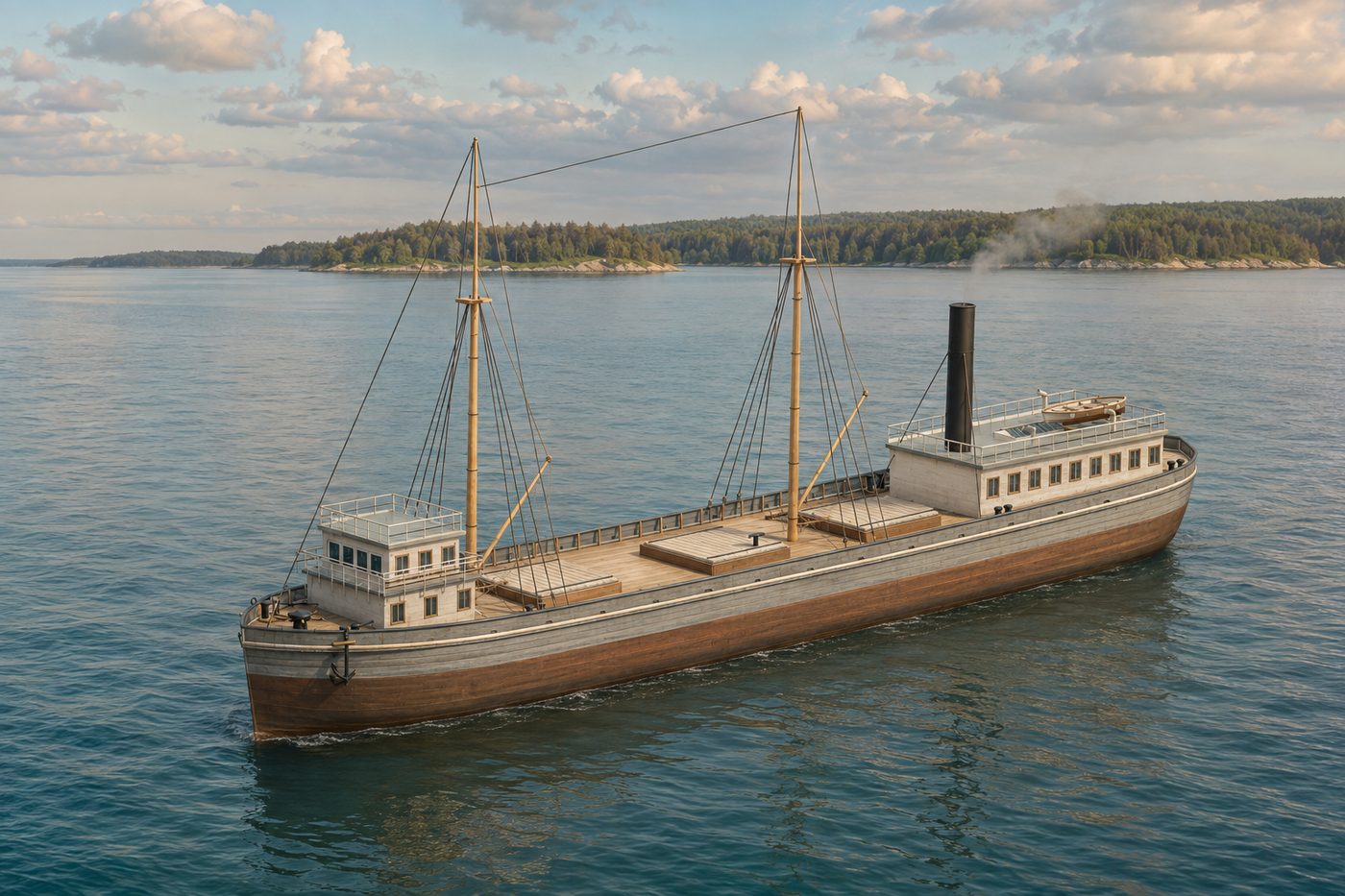
Intact bulk-freighter interpretation, 1873–1894
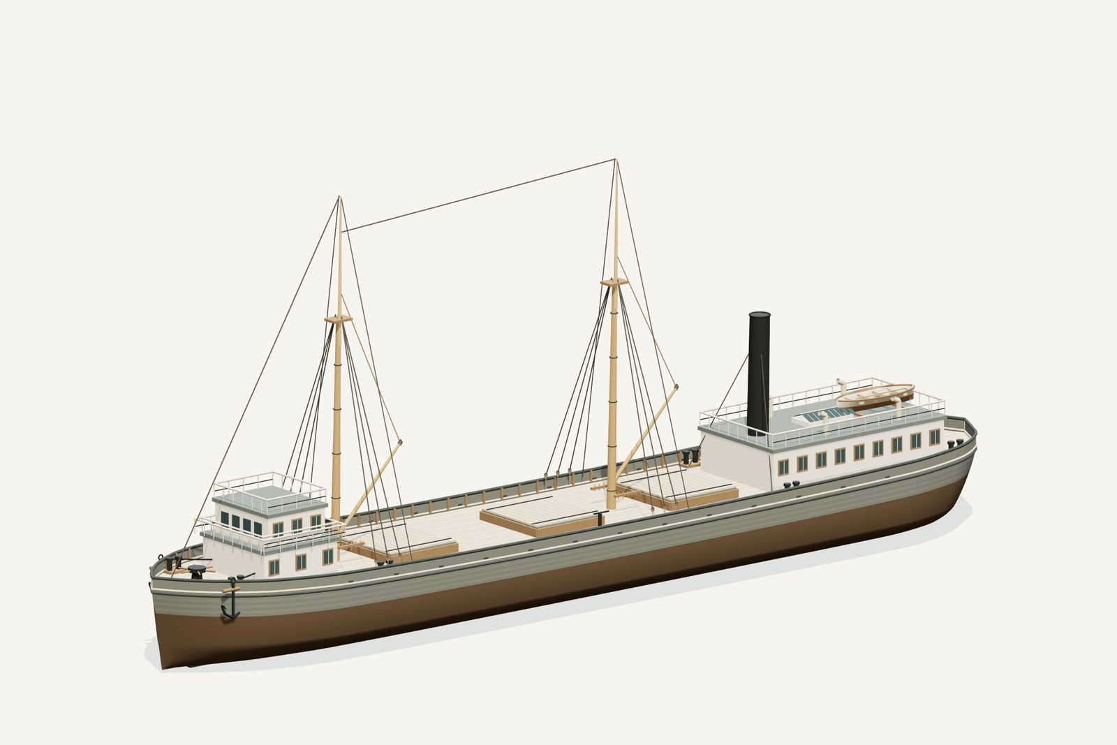
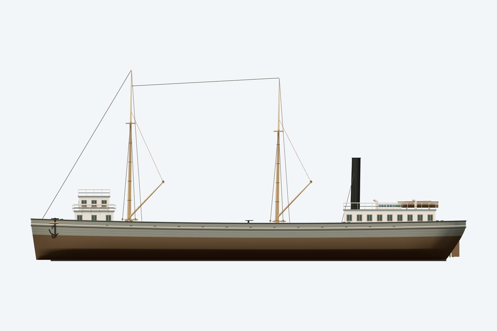
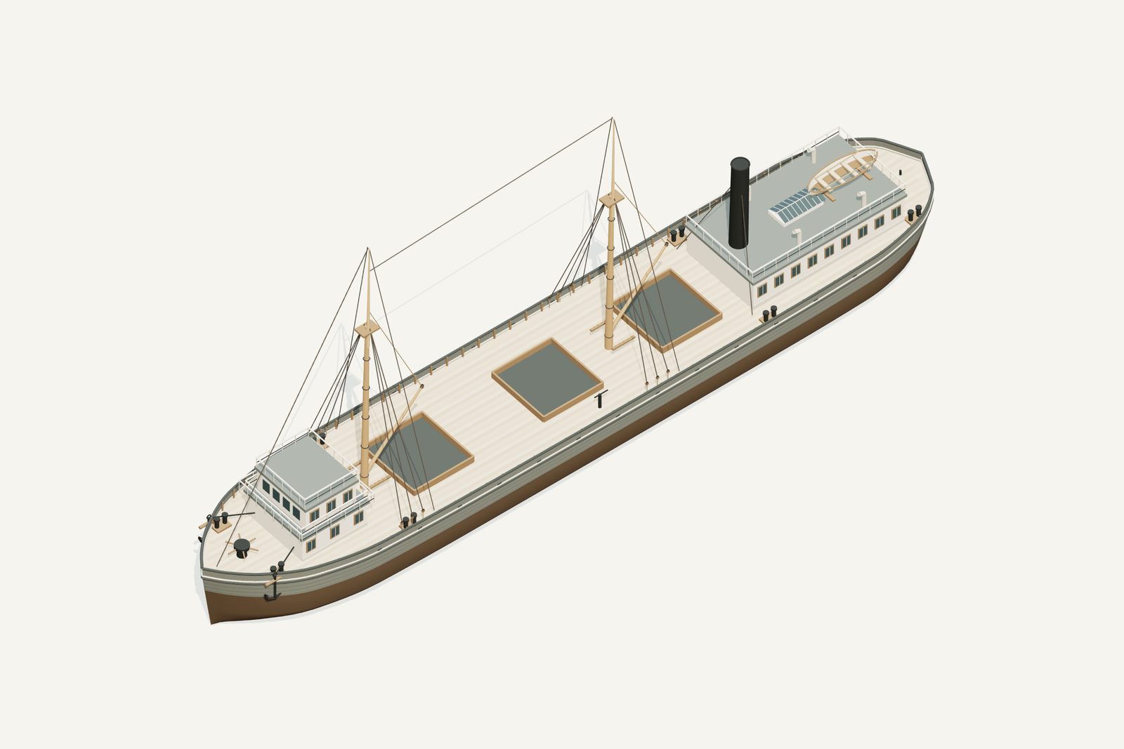
An interpretive 3D reconstruction of the vessel afloat, in the form named above and from before its loss in Thunder Bay. It is informed by the historical record set out under History below, where the documented evidence and the interpretation are kept apart; rigging, colours and fittings are partly inferred. It is not a survey of the wreck.
Nobody knows the exact spot where this ship went down, so the marker shows the general area.
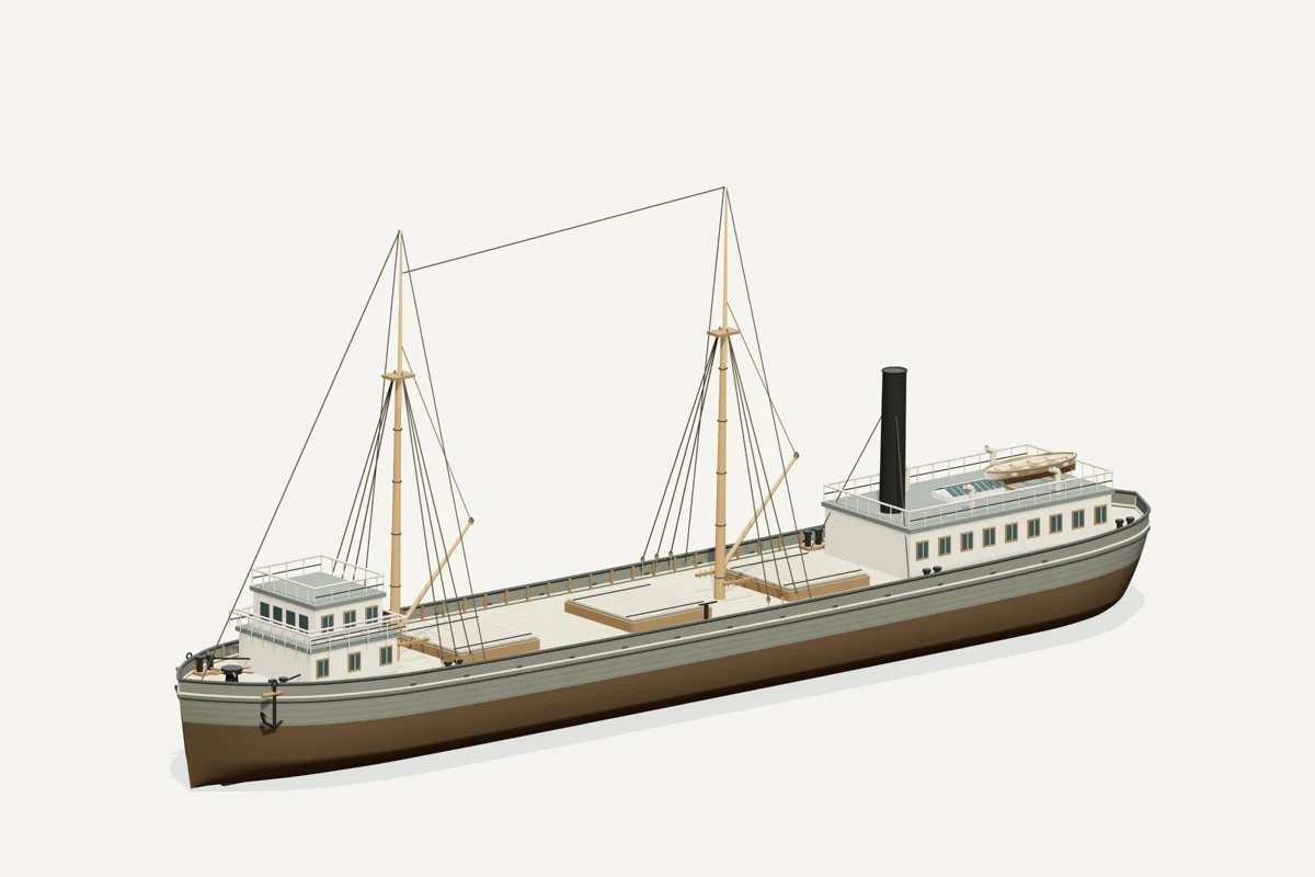
Starboard bow · complete vessel · drag to rotate, scroll or pinch to zoom, right-drag to pan. Hiding a part shows what sat beneath it; it does not recreate the wreck.
What the model represents
From the model specification. Two lists, kept apart on purpose.
Documented
- Wooden bulk freighter built by Simon Langell at St.Clair in 1873. NOAA D.M. Wilson record
- NOAA wreck dimensions 179×32 ft. NOAA D.M. Wilson record
Inferred
- Underwater hull lines and draft
- Exact colors, fittings, hatch layout and rigging routes
Configuration caveat. Documented: 179 × 32 ft hull, forward cargo area, aft boiler position and screw propulsion. Inferred: separated forward and aft houses follow contemporary Great Lakes bulk freighters; two bare working masts and hatch stations are provisional. No intact portrait or original arrangement plan was recovered.
Two numbers that are not the same thing. The waterline toggle sits at 2.90 m above the keel, a display assumption, not a measured draft. The wreck lies in about 48 ft of water; that describes the site, not the ship.
Renders from the model
History, evidence and limits
The research notes behind the reconstruction, reproduced with their citations.
Version 1.1. Metadata and presentation revised September 8, 2026; original evidence review retained.
Selected appearance
Intact bulk-freighter interpretation, 1873–1894. Documented: 179 × 32 ft hull, forward cargo area, aft boiler position and screw propulsion. Inferred: separated forward and aft houses follow contemporary Great Lakes bulk freighters; two bare working masts and hatch stations are provisional. No intact portrait or original arrangement plan was recovered.
Documented evidence
Wooden bulk freighter built by Simon Langell at St.Clair in 1873. NOAA D.M. Wilson record
NOAA wreck dimensions 179×32 ft. NOAA D.M. Wilson record
Reasonable interpretation
Underwater hull lines and draft
Exact colors, fittings, hatch layout and rigging routes
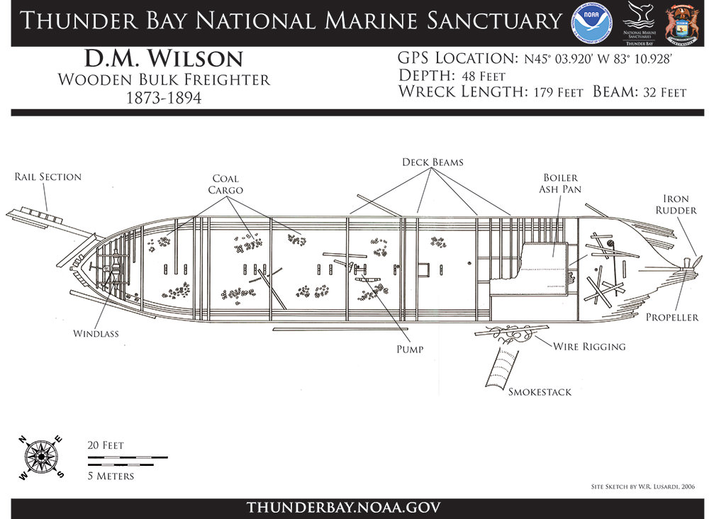
Documented on this vessel. NOAA records a wooden bulk freighter built in 1873 by Simon Langell at St. Clair, 179 ft wreck length and 32 ft beam, lost October 27, 1894 with coal. The model's 54.5592 × 9.7536 m hull uses these as approximate display baselines. NOAA vessel record. W.R. Lusardi's 2006 archaeological site sketch shows the long cargo body, forward windlass, aft boiler ash pan, displaced smokestack, pump, iron rudder and propeller. These support cargo forward of machinery and screw propulsion. The sketch is a wreck plan, not an intact deck or hull-lines drawing. NOAA site plan.
Reasonable inferences. A forward pilothouse and low aft engine/cabin group use the separated-house arrangement visible on the contemporary wooden bulk carrier B.W. Blanchard, built in 1870. This is a comparable working type, not a sister ship or proof of Wilson's cabins. Blanchard's conspicuous longitudinal support arches are not transferred to Wilson. The NPS heritage study also describes the forward steering position and aft machinery as a practical bulk-carrier arrangement. B.W. Blanchard historical photograph, NOAA Figures 9–10, NPS Michigan Maritime Heritage study, printed p.95.
Unresolved uncertainties
No complete original lines plan is claimed. Exact loaded draft, concealed surfaces and fine fittings remain interpreted. The earlier research context below retains the source distinctions used for this reconstruction.
Evidence assessment: build. The surviving hull plan, catalogue dimensions and machinery locations establish a defensible bulk-freighter form. Missing houses can be interpreted through contemporary Great Lakes bulk carriers, with their uncertainty made explicit. The model depicts a plausible intact working form within 1873–1894, not a proven configuration on the day of loss.
Uncertainties to retain in the visitor view. Hold depth is unknown and stored as null. Deck Y=4.05 m and waterline Y=2.9 m are display choices. NOAA's text says 40 ft wreck depth; its site plan and the worksheet say 48 ft. This discrepancy does not establish the ship's draft. setHatches(boolean) controls hatch_covers, exposing schematic dark wells. The model supplies no new wreck-location evidence.
Sources
- NOAA D.M. Wilson record
- W.R. Lusardi 2006 site sketch, NOAA
- NOAA historical overview: B.W. Blanchard photo
- NPS Michigan Maritime Heritage study
Illustration conditions
Lake, shoreline, lighting and weather are artistic staging, not evidence of a specific historical voyage. AI artwork is supplemental; the GLB and direct renders establish the delivered geometry.
Sources used for the model
- NOAA D.M. Wilson record — source
Dimensions, type, dates - W.R. Lusardi 2006 site sketch, NOAA — source
Cargo body, windlass, aft boiler area, stack, pump, rudder and propeller - NOAA historical overview: B.W. Blanchard photo — source
Contemporary bulk-carrier comparison; not a portrait of Wilson - NPS Michigan Maritime Heritage study — source
Printed p.95: general bulk-carrier arrangement; type inference only
Rights and respect
Removing or disturbing wreckage on Great Lakes bottomlands is a felony under Michigan Part 761, 1994 PA 451, at a fair market value of $100 or more. Positions are historical reference only — not navigation and not dive-planning data. Wreck records are published by the Michigan Underwater Preserve Council.
Treat these as graves. Lives were lost on many Great Lakes wrecks and human remains may still be present. Look, photograph, and leave everything exactly as you found it.
Model and renders were newly made for this project (2026). Three.js r160.1 is used under the MIT licence; its notice ships with the vendored files. Wreck position, depth and dates: Michigan Underwater Preserve Council. The model specification (version 1.1, revised 2026-09-08) is published beside the assets (model-spec.json).