Bay City
Original brig-rigged career, 1857–1869
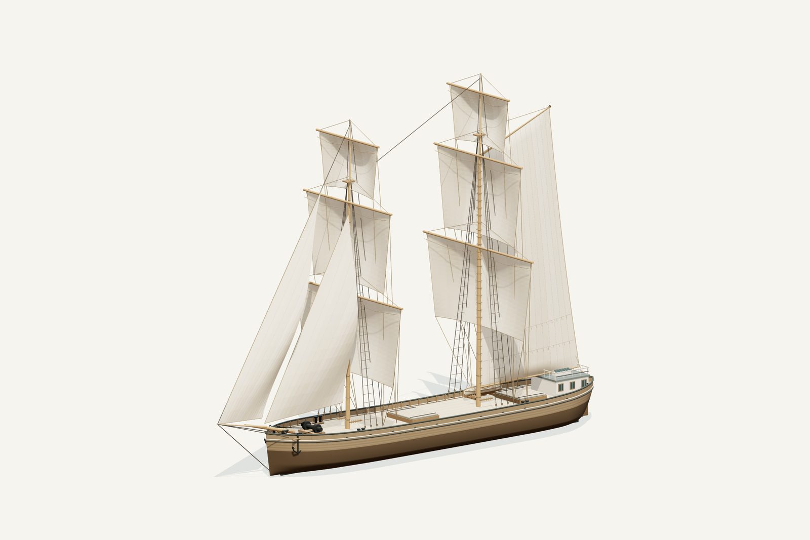
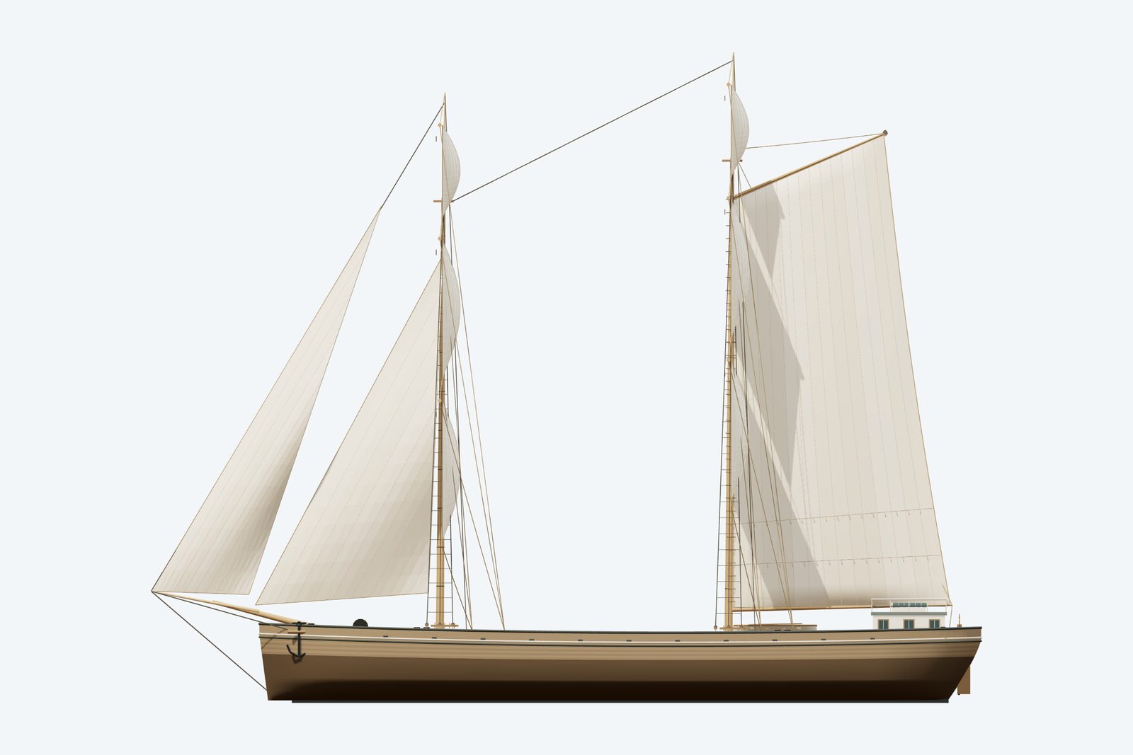
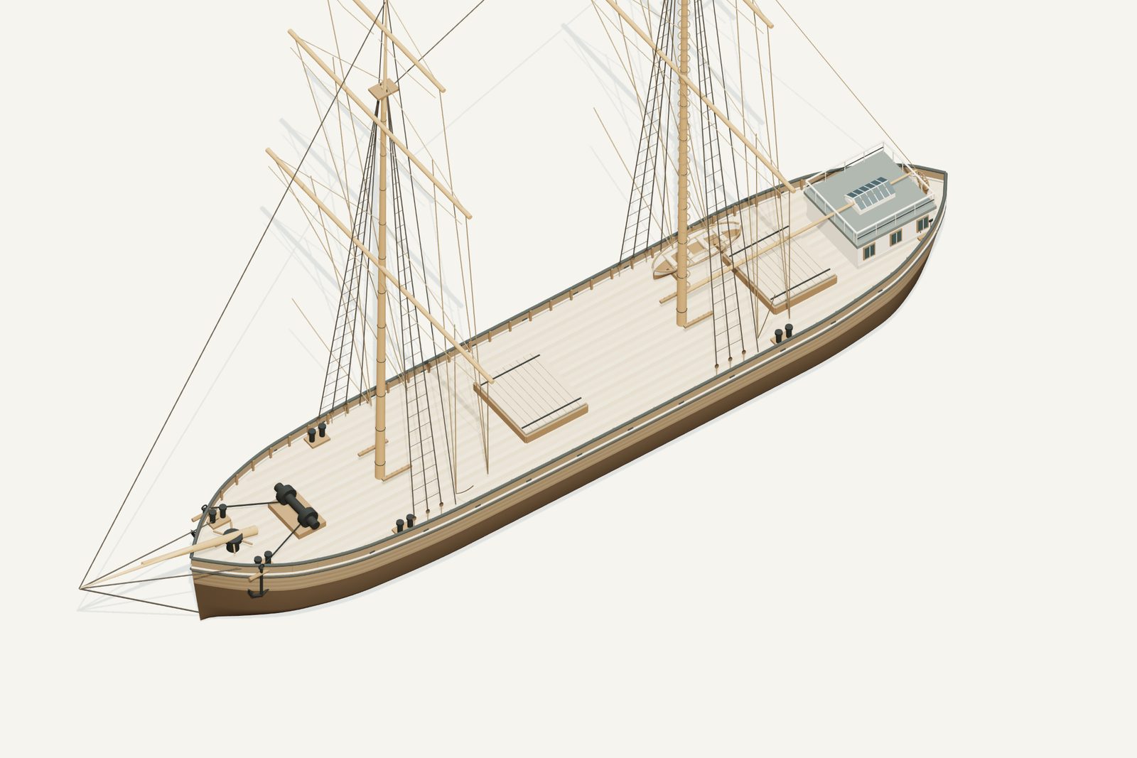
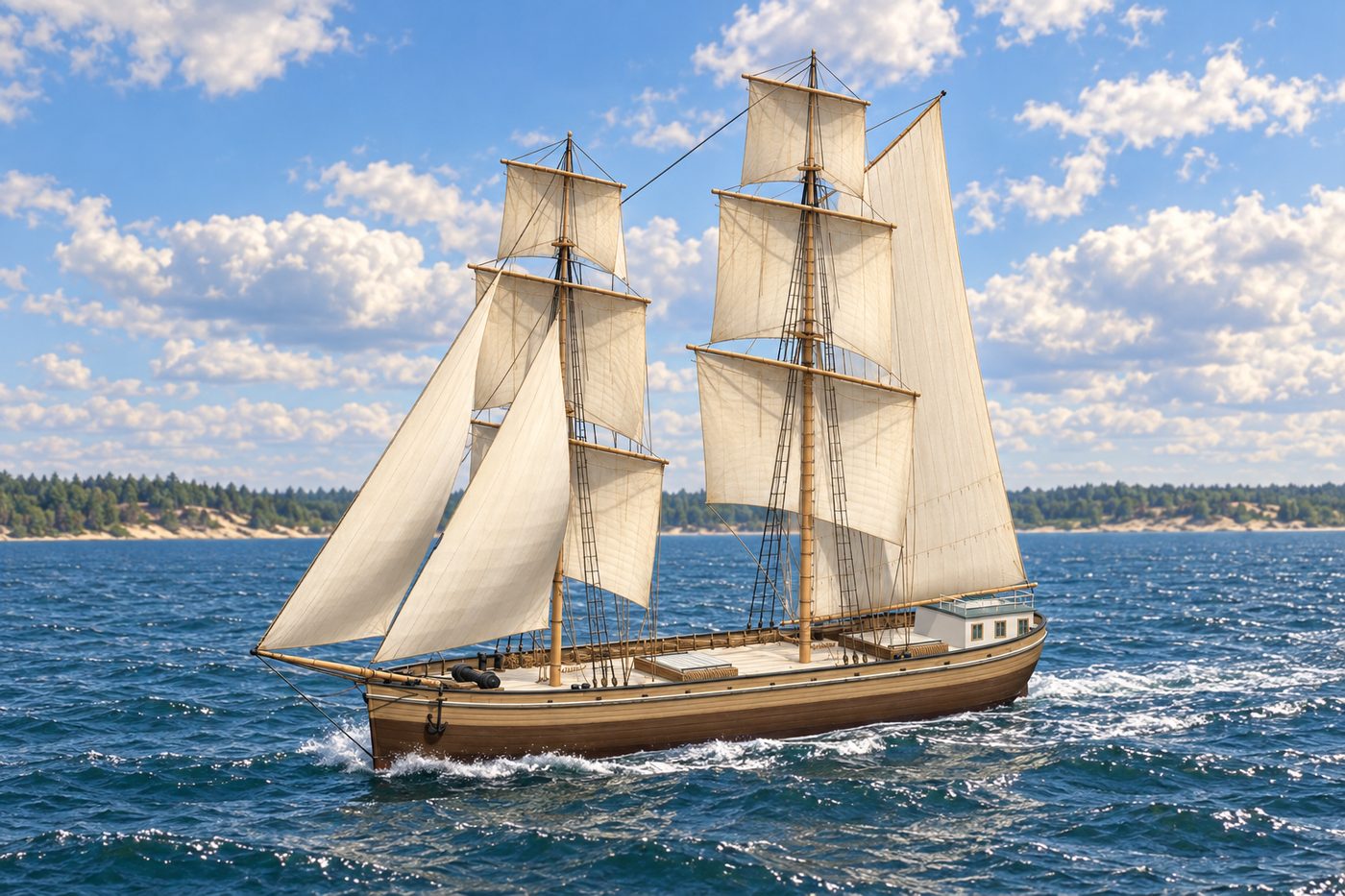
An interpretive 3D reconstruction of the vessel afloat, in the form named above and from before its loss in Thunder Bay. It is informed by the historical record set out under History below, where the documented evidence and the interpretation are kept apart; rigging, colours and fittings are partly inferred. It is not a survey of the wreck.
This ship ran aground along this shore. Nobody knows the exact spot, so the marker shows the general area.
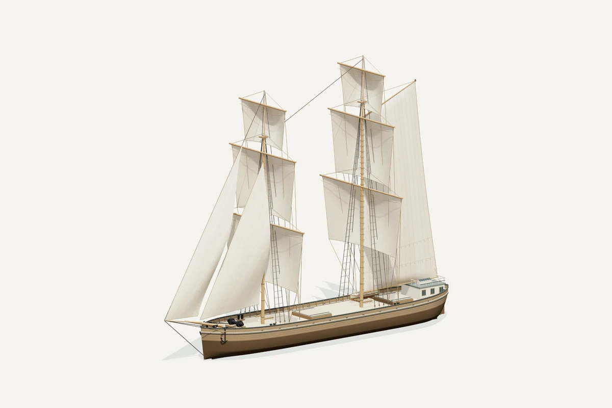
Starboard bow · complete vessel · drag to rotate, scroll or pinch to zoom, right-drag to pan. Hiding the sails shows the deck; it does not recreate the wreck.
What the model represents
From the model specification. Two lists, kept apart on purpose.
Documented
- NOAA’s vessel record identifies a wooden two-masted schooner barge built in 1857 and lost in 1902. The 146 ft figure describes the wreck, not a verified original brig hull length. NOAA.
- Visit Alpena describes Bay City as originally brig-rigged and cut down after burning at Detroit in 1869. It also records stern loss from the later wreck. Visit Alpena.
Inferred
- The original brig’s two square-rigged masts are supported as a configuration, while their heights, yard spans, sail areas and stations are period-proportion interpretations.
- The revised main mast is about 120 ft above deck and the lower yards about twice the beam; these are comparative rig proportions, not measured Bay City spars.
- Using 146 ft as the display hull baseline is a qualified proxy from surviving wreck length. Cabin, hatches, paint and concealed hull remain inferred.
Configuration caveat. Shown in the original brig rig, 1857–1869; after the 1869 fire she was cut down and later wrecked as a two-masted schooner barge. Rig dimensions are period inferences. The 146 ft geometry baseline is surviving wreck length, not an established original complete length.
Two numbers that are not the same thing. The waterline toggle sits at 2.70 m above the keel, a display assumption, not a measured draft. The wreck lies in about 11 ft of water; that describes the site, not the ship.
Renders from the model
History, evidence and limits
The research notes behind the reconstruction, reproduced with their citations.
Version 1.1. Revised September 8, 2026.
Selected appearance
Original brig-rigged career, 1857–1869. Bay City was cut down after a Detroit fire in 1869 and was a two-masted schooner barge at its 1902 loss; the model deliberately depicts the earlier form.
Documented evidence
NOAA’s vessel record identifies a wooden two-masted schooner barge built in 1857 and lost in 1902. The 146 ft figure describes the wreck, not a verified original brig hull length. NOAA.
Visit Alpena describes Bay City as originally brig-rigged and cut down after burning at Detroit in 1869. It also records stern loss from the later wreck. Visit Alpena.
Reasonable interpretation
The original brig’s two square-rigged masts are supported as a configuration, while their heights, yard spans, sail areas and stations are period-proportion interpretations.
The revised main mast is about 120 ft above deck and the lower yards about twice the beam; these are comparative rig proportions, not measured Bay City spars.
Using 146 ft as the display hull baseline is a qualified proxy from surviving wreck length. Cabin, hatches, paint and concealed hull remain inferred.
Unresolved uncertainties
No original rig plan establishes exact spar dimensions or the original complete hull length. The 1902 wreck’s cut-down and damaged state cannot certify its 1857 dimensions.
The former three-mast loss description conflicts with NOAA’s two-masted barge record and is corrected. The 1869 conversion does not make the brig model a loss-day depiction.
Sources
Illustration conditions
Supplemental AI artwork is made from the revised model render where the model changed; the provenance records the actual input files. Lake, shore, sky and weather are artistic staging, not evidence of a final voyage or a measured location. The actual GLB and its direct renders are the geometry reference.
Rights and respect
Removing or disturbing wreckage on Great Lakes bottomlands is a felony under Michigan Part 761, 1994 PA 451, at a fair market value of $100 or more. Positions are historical reference only — not navigation and not dive-planning data. Wreck records are published by the Michigan Underwater Preserve Council.
Treat these as graves. Lives were lost on many Great Lakes wrecks and human remains may still be present. Look, photograph, and leave everything exactly as you found it.
Model and renders were newly made for this project (2026). Three.js r160.1 is used under the MIT licence; its notice ships with the vendored files. Wreck position, depth and dates: Michigan Underwater Preserve Council. The model specification (version 1.1, revised 2026-09-08) is published beside the assets (model-spec.json).